You are here: Home > Network List > AV - Alaska Volcano Observatory Stations List
> Station MAPS Pakushin Southeast, Makushin Volcano, Alaska > Earthquake Result Viewer
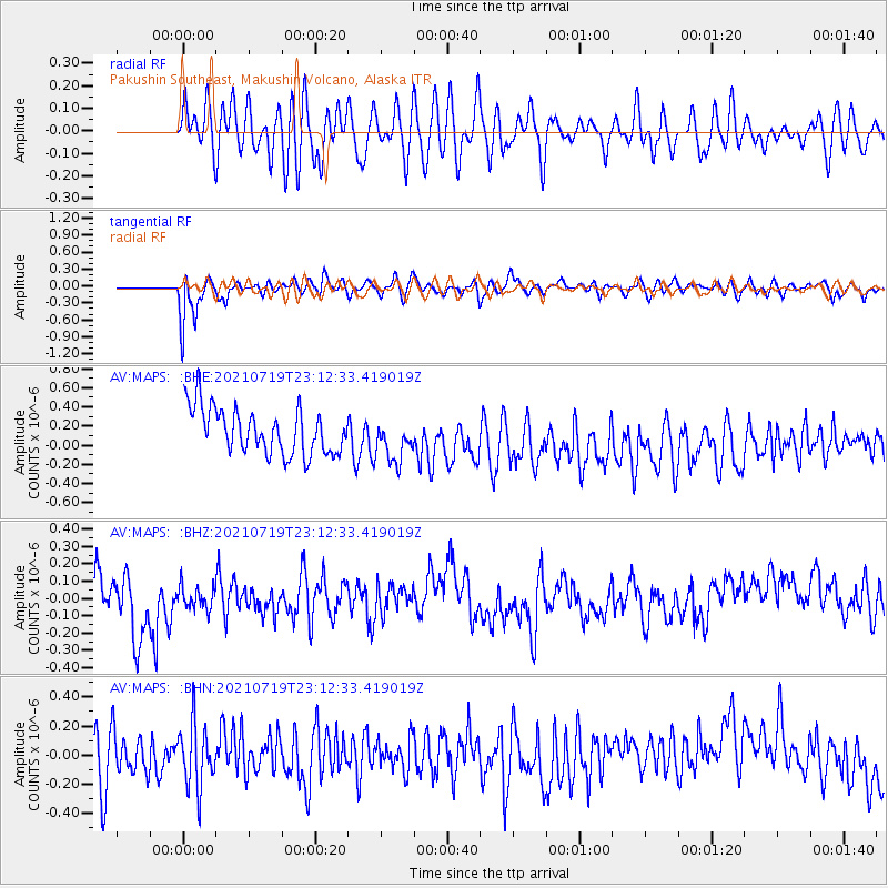
MAPS Pakushin Southeast, Makushin Volcano, Alaska - Earthquake Result Viewer
*The percent match for this event was below the threshold and hence no stack was calculated.
| Earthquake location: |
New Britain Region, P.N.G. |
| Earthquake latitude/longitude: |
-5.0/152.1 |
| Earthquake time(UTC): |
2021/07/19 (200) 23:02:08 GMT |
| Earthquake Depth: |
28 km |
| Earthquake Magnitude: |
5.4 mww |
| Earthquake Catalog/Contributor: |
NEIC PDE/us |
|
| Network: |
AV Alaska Volcano Observatory |
| Station: |
MAPS Pakushin Southeast, Makushin Volcano, Alaska |
| Lat/Lon: |
53.81 N/166.94 W |
| Elevation: |
333 m |
|
| Distance: |
67.9 deg |
| Az: |
24.792 deg |
| Baz: |
224.777 deg |
| Ray Param: |
$rayparam |
*The percent match for this event was below the threshold and hence was not used in the summary stack. |
|
| Radial Match: |
50.248234 % |
| Radial Bump: |
400 |
| Transverse Match: |
69.0984 % |
| Transverse Bump: |
400 |
| SOD ConfigId: |
25131211 |
| Insert Time: |
2021-08-02 23:07:50.763 +0000 |
| GWidth: |
2.5 |
| Max Bumps: |
400 |
| Tol: |
0.001 |
|
Signal To Noise
| Channel | StoN | STA | LTA |
| AV:MAPS: :BHZ:20210719T23:12:33.419019Z | 0.6163645 | 8.785537E-8 | 1.4253801E-7 |
| AV:MAPS: :BHN:20210719T23:12:33.419019Z | 1.300089 | 2.7363083E-7 | 2.1047086E-7 |
| AV:MAPS: :BHE:20210719T23:12:33.419019Z | 0.9431073 | 2.2455369E-7 | 2.3809983E-7 |
| Arrivals |
| Ps | |
| PpPs | |
| PsPs/PpSs | |


