You are here: Home > Network List > US - United States National Seismic Network Stations List
> Station HAWA Hanford, Washington, USA > Earthquake Result Viewer
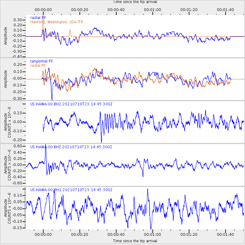
HAWA Hanford, Washington, USA - Earthquake Result Viewer
*The percent match for this event was below the threshold and hence no stack was calculated.
| Earthquake location: |
New Britain Region, P.N.G. |
| Earthquake latitude/longitude: |
-5.0/152.1 |
| Earthquake time(UTC): |
2021/07/19 (200) 23:02:08 GMT |
| Earthquake Depth: |
28 km |
| Earthquake Magnitude: |
5.4 mww |
| Earthquake Catalog/Contributor: |
NEIC PDE/us |
|
| Network: |
US United States National Seismic Network |
| Station: |
HAWA Hanford, Washington, USA |
| Lat/Lon: |
46.39 N/119.53 W |
| Elevation: |
364 m |
|
| Distance: |
92.5 deg |
| Az: |
43.827 deg |
| Baz: |
265.339 deg |
| Ray Param: |
$rayparam |
*The percent match for this event was below the threshold and hence was not used in the summary stack. |
|
| Radial Match: |
50.081444 % |
| Radial Bump: |
400 |
| Transverse Match: |
51.52688 % |
| Transverse Bump: |
400 |
| SOD ConfigId: |
25131211 |
| Insert Time: |
2021-08-02 23:17:56.245 +0000 |
| GWidth: |
2.5 |
| Max Bumps: |
400 |
| Tol: |
0.001 |
|
Signal To Noise
| Channel | StoN | STA | LTA |
| US:HAWA:00:BHZ:20210719T23:14:45.300Z | 3.710198 | 2.2151005E-7 | 5.970303E-8 |
| US:HAWA:00:BH1:20210719T23:14:45.300Z | 0.98423266 | 6.741535E-8 | 6.849534E-8 |
| US:HAWA:00:BH2:20210719T23:14:45.300Z | 2.132029 | 8.6947445E-8 | 4.0781547E-8 |
| Arrivals |
| Ps | |
| PpPs | |
| PsPs/PpSs | |


