You are here: Home > Network List > US - United States National Seismic Network Stations List
> Station MSO Missoula, Montana, USA > Earthquake Result Viewer
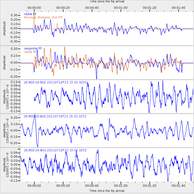
MSO Missoula, Montana, USA - Earthquake Result Viewer
*The percent match for this event was below the threshold and hence no stack was calculated.
| Earthquake location: |
New Britain Region, P.N.G. |
| Earthquake latitude/longitude: |
-5.0/152.1 |
| Earthquake time(UTC): |
2021/07/19 (200) 23:02:08 GMT |
| Earthquake Depth: |
28 km |
| Earthquake Magnitude: |
5.4 mww |
| Earthquake Catalog/Contributor: |
NEIC PDE/us |
|
| Network: |
US United States National Seismic Network |
| Station: |
MSO Missoula, Montana, USA |
| Lat/Lon: |
46.83 N/113.94 W |
| Elevation: |
1264 m |
|
| Distance: |
96.3 deg |
| Az: |
43.567 deg |
| Baz: |
269.411 deg |
| Ray Param: |
$rayparam |
*The percent match for this event was below the threshold and hence was not used in the summary stack. |
|
| Radial Match: |
47.54811 % |
| Radial Bump: |
400 |
| Transverse Match: |
47.85584 % |
| Transverse Bump: |
400 |
| SOD ConfigId: |
25131211 |
| Insert Time: |
2021-08-02 23:17:59.299 +0000 |
| GWidth: |
2.5 |
| Max Bumps: |
400 |
| Tol: |
0.001 |
|
Signal To Noise
| Channel | StoN | STA | LTA |
| US:MSO:00:BHZ:20210719T23:15:02.925Z | 3.3734262 | 1.5256498E-7 | 4.5225526E-8 |
| US:MSO:00:BH1:20210719T23:15:02.925Z | 0.7926317 | 2.7425093E-8 | 3.460005E-8 |
| US:MSO:00:BH2:20210719T23:15:02.925Z | 1.0224156 | 4.0578374E-8 | 3.9688725E-8 |
| Arrivals |
| Ps | |
| PpPs | |
| PsPs/PpSs | |


