You are here: Home > Network List > US - United States National Seismic Network Stations List
> Station WUAZ Wupatki, Arizona, USA > Earthquake Result Viewer
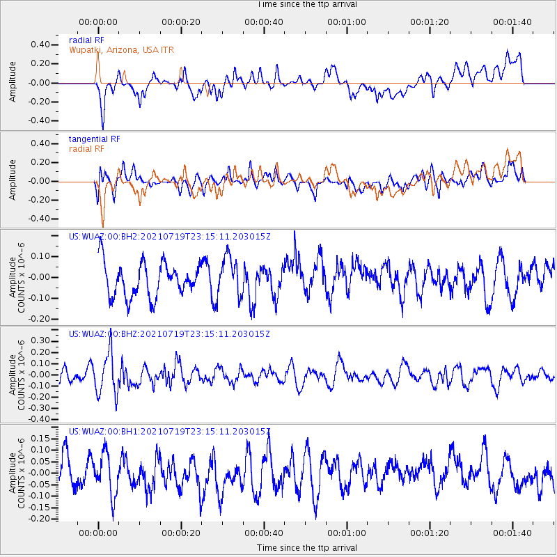
WUAZ Wupatki, Arizona, USA - Earthquake Result Viewer
*The percent match for this event was below the threshold and hence no stack was calculated.
| Earthquake location: |
New Britain Region, P.N.G. |
| Earthquake latitude/longitude: |
-5.0/152.1 |
| Earthquake time(UTC): |
2021/07/19 (200) 23:02:08 GMT |
| Earthquake Depth: |
28 km |
| Earthquake Magnitude: |
5.4 mww |
| Earthquake Catalog/Contributor: |
NEIC PDE/us |
|
| Network: |
US United States National Seismic Network |
| Station: |
WUAZ Wupatki, Arizona, USA |
| Lat/Lon: |
35.52 N/111.37 W |
| Elevation: |
1592 m |
|
| Distance: |
98.2 deg |
| Az: |
54.973 deg |
| Baz: |
269.659 deg |
| Ray Param: |
$rayparam |
*The percent match for this event was below the threshold and hence was not used in the summary stack. |
|
| Radial Match: |
52.14285 % |
| Radial Bump: |
400 |
| Transverse Match: |
45.818493 % |
| Transverse Bump: |
400 |
| SOD ConfigId: |
25131211 |
| Insert Time: |
2021-08-02 23:18:05.270 +0000 |
| GWidth: |
2.5 |
| Max Bumps: |
400 |
| Tol: |
0.001 |
|
Signal To Noise
| Channel | StoN | STA | LTA |
| US:WUAZ:00:BHZ:20210719T23:15:11.203015Z | 2.880566 | 1.8804033E-7 | 6.5278954E-8 |
| US:WUAZ:00:BH1:20210719T23:15:11.203015Z | 1.5221399 | 9.231408E-8 | 6.064757E-8 |
| US:WUAZ:00:BH2:20210719T23:15:11.203015Z | 1.1550207 | 9.416297E-8 | 8.1524924E-8 |
| Arrivals |
| Ps | |
| PpPs | |
| PsPs/PpSs | |


