You are here: Home > Network List > UW - Pacific Northwest Regional Seismic Network Stations List
> Station UMAT Pilot Rock, OR, USA > Earthquake Result Viewer
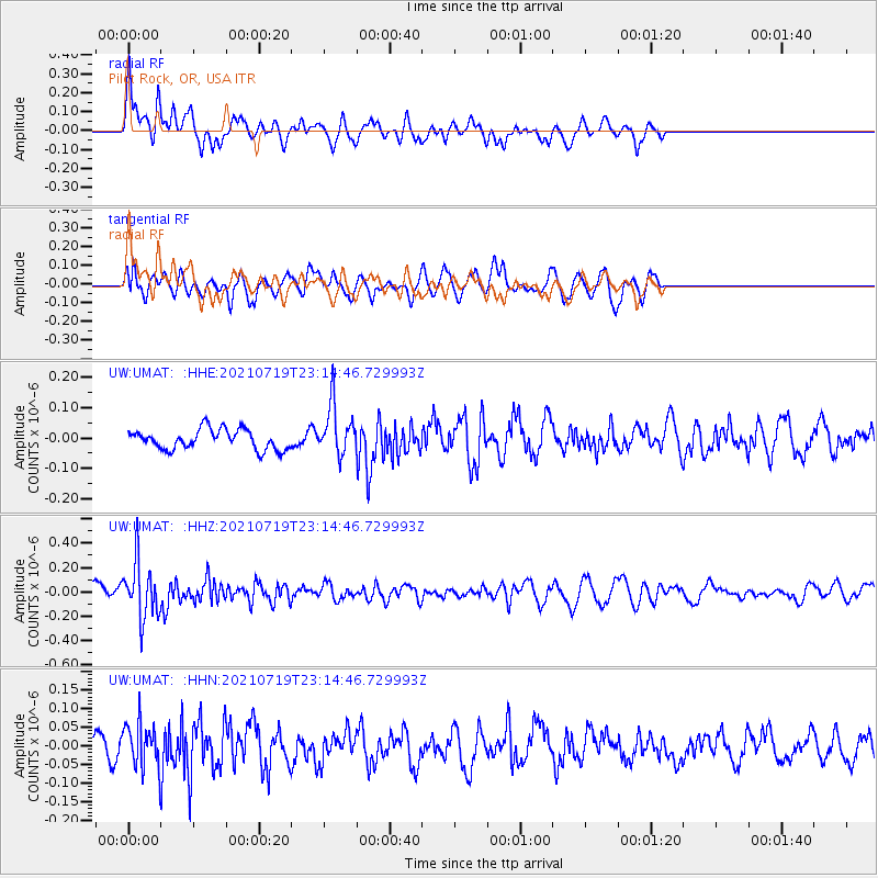
UMAT Pilot Rock, OR, USA - Earthquake Result Viewer
*The percent match for this event was below the threshold and hence no stack was calculated.
| Earthquake location: |
New Britain Region, P.N.G. |
| Earthquake latitude/longitude: |
-5.0/152.1 |
| Earthquake time(UTC): |
2021/07/19 (200) 23:02:08 GMT |
| Earthquake Depth: |
28 km |
| Earthquake Magnitude: |
5.4 mww |
| Earthquake Catalog/Contributor: |
NEIC PDE/us |
|
| Network: |
UW Pacific Northwest Regional Seismic Network |
| Station: |
UMAT Pilot Rock, OR, USA |
| Lat/Lon: |
45.29 N/118.96 W |
| Elevation: |
1318 m |
|
| Distance: |
92.8 deg |
| Az: |
44.958 deg |
| Baz: |
265.697 deg |
| Ray Param: |
$rayparam |
*The percent match for this event was below the threshold and hence was not used in the summary stack. |
|
| Radial Match: |
61.68167 % |
| Radial Bump: |
400 |
| Transverse Match: |
59.597366 % |
| Transverse Bump: |
400 |
| SOD ConfigId: |
25131211 |
| Insert Time: |
2021-08-02 23:19:52.705 +0000 |
| GWidth: |
2.5 |
| Max Bumps: |
400 |
| Tol: |
0.001 |
|
Signal To Noise
| Channel | StoN | STA | LTA |
| UW:UMAT: :HHZ:20210719T23:14:46.729993Z | 3.247327 | 2.2858676E-7 | 7.039228E-8 |
| UW:UMAT: :HHN:20210719T23:14:46.729993Z | 2.144542 | 5.7443327E-8 | 2.6785825E-8 |
| UW:UMAT: :HHE:20210719T23:14:46.729993Z | 2.5387692 | 8.353643E-8 | 3.29043E-8 |
| Arrivals |
| Ps | |
| PpPs | |
| PsPs/PpSs | |


