You are here: Home > Network List > US - United States National Seismic Network Stations List
> Station AMTX Amarillo, Texas, USA > Earthquake Result Viewer
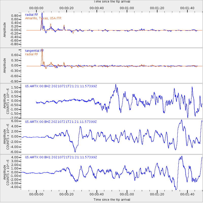
AMTX Amarillo, Texas, USA - Earthquake Result Viewer
*The percent match for this event was below the threshold and hence no stack was calculated.
| Earthquake location: |
South Of Panama |
| Earthquake latitude/longitude: |
7.4/-82.8 |
| Earthquake time(UTC): |
2021/07/21 (202) 21:15:12 GMT |
| Earthquake Depth: |
10 km |
| Earthquake Magnitude: |
6.7 mww |
| Earthquake Catalog/Contributor: |
NEIC PDE/us |
|
| Network: |
US United States National Seismic Network |
| Station: |
AMTX Amarillo, Texas, USA |
| Lat/Lon: |
34.53 N/101.41 W |
| Elevation: |
1010 m |
|
| Distance: |
32.0 deg |
| Az: |
330.159 deg |
| Baz: |
143.289 deg |
| Ray Param: |
$rayparam |
*The percent match for this event was below the threshold and hence was not used in the summary stack. |
|
| Radial Match: |
91.427986 % |
| Radial Bump: |
247 |
| Transverse Match: |
64.214195 % |
| Transverse Bump: |
400 |
| SOD ConfigId: |
25131211 |
| Insert Time: |
2021-08-04 21:37:29.045 +0000 |
| GWidth: |
2.5 |
| Max Bumps: |
400 |
| Tol: |
0.001 |
|
Signal To Noise
| Channel | StoN | STA | LTA |
| US:AMTX:00:BHZ:20210721T21:21:11.57399Z | 0.8415096 | 8.827715E-8 | 1.04903314E-7 |
| US:AMTX:00:BH1:20210721T21:21:11.57399Z | 1.758169 | 1.7213536E-7 | 9.7906025E-8 |
| US:AMTX:00:BH2:20210721T21:21:11.57399Z | 1.8716922 | 1.9644567E-7 | 1.04956186E-7 |
| Arrivals |
| Ps | |
| PpPs | |
| PsPs/PpSs | |


