You are here: Home > Network List > AZ - ANZA Regional Network Stations List
> Station SMER AZ.SMER > Earthquake Result Viewer
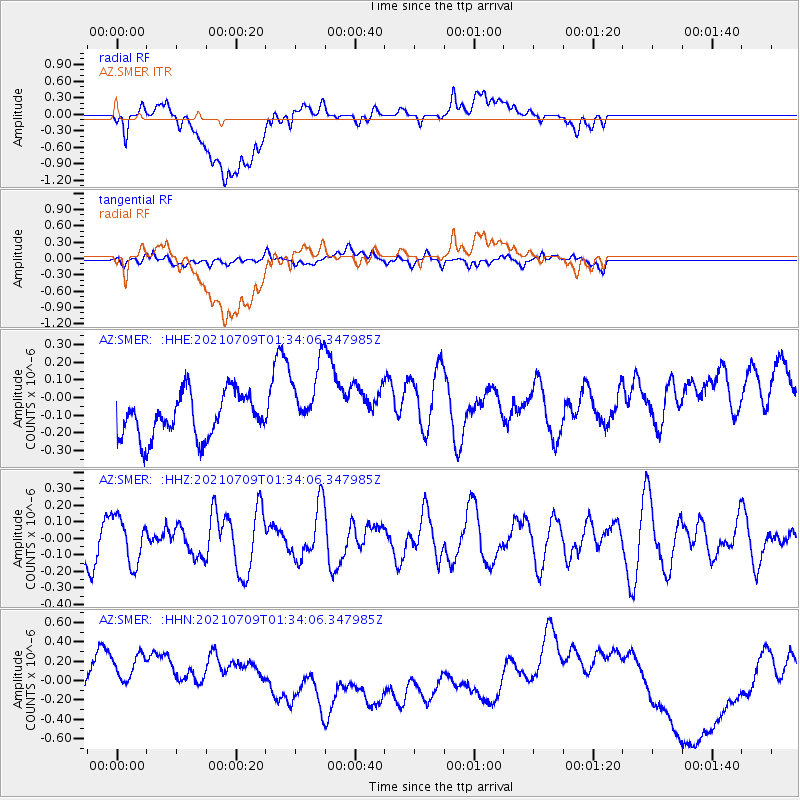
SMER AZ.SMER - Earthquake Result Viewer
*The percent match for this event was below the threshold and hence no stack was calculated.
| Earthquake location: |
Pacific-Antarctic Ridge |
| Earthquake latitude/longitude: |
-56.2/-143.2 |
| Earthquake time(UTC): |
2021/07/09 (190) 01:21:29 GMT |
| Earthquake Depth: |
10 km |
| Earthquake Magnitude: |
5.5 Mww |
| Earthquake Catalog/Contributor: |
NEIC PDE/us |
|
| Network: |
AZ ANZA Regional Network |
| Station: |
SMER AZ.SMER |
| Lat/Lon: |
33.46 N/117.17 W |
| Elevation: |
355 m |
|
| Distance: |
92.0 deg |
| Az: |
21.553 deg |
| Baz: |
194.218 deg |
| Ray Param: |
$rayparam |
*The percent match for this event was below the threshold and hence was not used in the summary stack. |
|
| Radial Match: |
25.740313 % |
| Radial Bump: |
400 |
| Transverse Match: |
46.7443 % |
| Transverse Bump: |
400 |
| SOD ConfigId: |
25131211 |
| Insert Time: |
2021-08-05 21:28:18.615 +0000 |
| GWidth: |
2.5 |
| Max Bumps: |
400 |
| Tol: |
0.001 |
|
Signal To Noise
| Channel | StoN | STA | LTA |
| AZ:SMER: :HHZ:20210709T01:34:06.347985Z | 1.0201509 | 1.4039388E-7 | 1.376207E-7 |
| AZ:SMER: :HHN:20210709T01:34:06.347985Z | 2.856162 | 4.671608E-7 | 1.6356242E-7 |
| AZ:SMER: :HHE:20210709T01:34:06.347985Z | 1.6459607 | 2.0493745E-7 | 1.2450931E-7 |
| Arrivals |
| Ps | |
| PpPs | |
| PsPs/PpSs | |


