You are here: Home > Network List > CI - Caltech Regional Seismic Network Stations List
> Station MPP McPhearson Peak > Earthquake Result Viewer
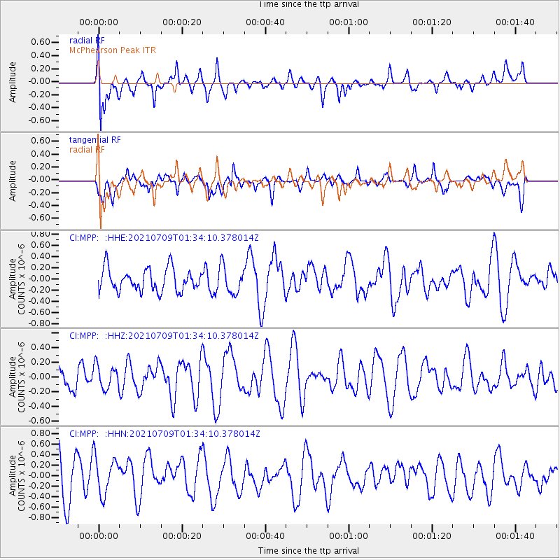
MPP McPhearson Peak - Earthquake Result Viewer
*The percent match for this event was below the threshold and hence no stack was calculated.
| Earthquake location: |
Pacific-Antarctic Ridge |
| Earthquake latitude/longitude: |
-56.2/-143.2 |
| Earthquake time(UTC): |
2021/07/09 (190) 01:21:29 GMT |
| Earthquake Depth: |
10 km |
| Earthquake Magnitude: |
5.5 Mww |
| Earthquake Catalog/Contributor: |
NEIC PDE/us |
|
| Network: |
CI Caltech Regional Seismic Network |
| Station: |
MPP McPhearson Peak |
| Lat/Lon: |
34.89 N/119.81 W |
| Elevation: |
1739 m |
|
| Distance: |
92.9 deg |
| Az: |
19.087 deg |
| Baz: |
192.846 deg |
| Ray Param: |
$rayparam |
*The percent match for this event was below the threshold and hence was not used in the summary stack. |
|
| Radial Match: |
49.3182 % |
| Radial Bump: |
400 |
| Transverse Match: |
49.498726 % |
| Transverse Bump: |
400 |
| SOD ConfigId: |
25131211 |
| Insert Time: |
2021-08-05 21:30:03.156 +0000 |
| GWidth: |
2.5 |
| Max Bumps: |
400 |
| Tol: |
0.001 |
|
Signal To Noise
| Channel | StoN | STA | LTA |
| CI:MPP: :HHZ:20210709T01:34:10.378014Z | 0.9955028 | 1.5912354E-7 | 1.5984237E-7 |
| CI:MPP: :HHN:20210709T01:34:10.378014Z | 0.9105921 | 3.460326E-7 | 3.8000837E-7 |
| CI:MPP: :HHE:20210709T01:34:10.378014Z | 1.2584087 | 2.5378748E-7 | 2.0167336E-7 |
| Arrivals |
| Ps | |
| PpPs | |
| PsPs/PpSs | |


