You are here: Home > Network List > CN - Canadian National Seismograph Network Stations List
> Station INK INUVIK, NT > Earthquake Result Viewer
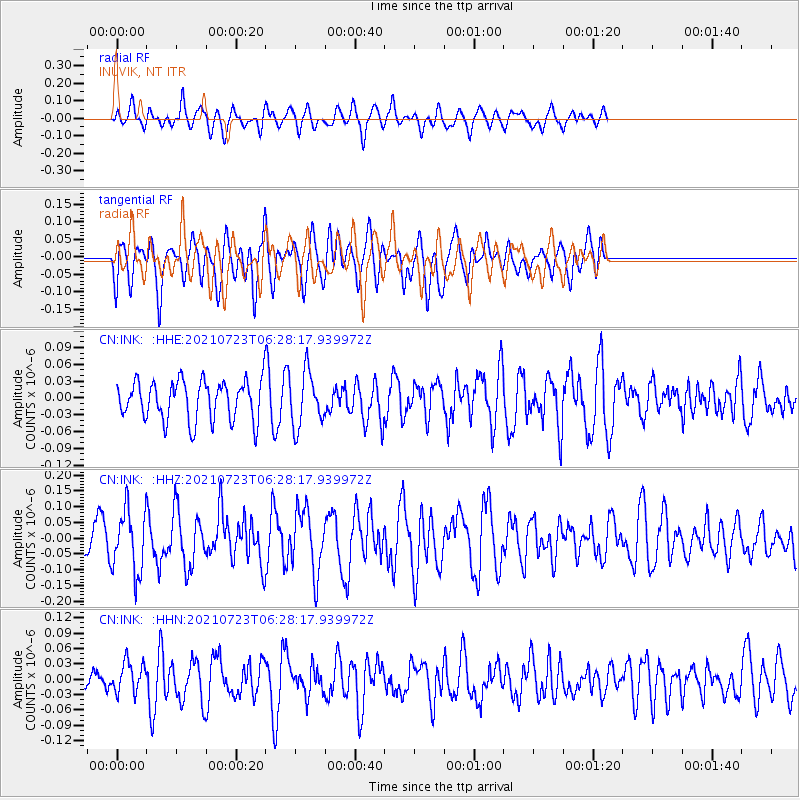
INK INUVIK, NT - Earthquake Result Viewer
*The percent match for this event was below the threshold and hence no stack was calculated.
| Earthquake location: |
New Ireland Region, P.N.G. |
| Earthquake latitude/longitude: |
-4.7/153.0 |
| Earthquake time(UTC): |
2021/07/23 (204) 06:16:03 GMT |
| Earthquake Depth: |
55 km |
| Earthquake Magnitude: |
5.5 Mww |
| Earthquake Catalog/Contributor: |
NEIC PDE/us |
|
| Network: |
CN Canadian National Seismograph Network |
| Station: |
INK INUVIK, NT |
| Lat/Lon: |
68.31 N/133.53 W |
| Elevation: |
44 m |
|
| Distance: |
88.3 deg |
| Az: |
20.89 deg |
| Baz: |
252.921 deg |
| Ray Param: |
$rayparam |
*The percent match for this event was below the threshold and hence was not used in the summary stack. |
|
| Radial Match: |
54.64818 % |
| Radial Bump: |
400 |
| Transverse Match: |
48.660378 % |
| Transverse Bump: |
400 |
| SOD ConfigId: |
25131211 |
| Insert Time: |
2021-08-06 06:21:43.203 +0000 |
| GWidth: |
2.5 |
| Max Bumps: |
400 |
| Tol: |
0.001 |
|
Signal To Noise
| Channel | StoN | STA | LTA |
| CN:INK: :HHZ:20210723T06:28:17.939972Z | 2.7857614 | 9.741201E-8 | 3.4967822E-8 |
| CN:INK: :HHN:20210723T06:28:17.939972Z | 0.59256655 | 2.9970813E-8 | 5.0577974E-8 |
| CN:INK: :HHE:20210723T06:28:17.939972Z | 1.3720716 | 4.8184628E-8 | 3.5118155E-8 |
| Arrivals |
| Ps | |
| PpPs | |
| PsPs/PpSs | |


