You are here: Home > Network List > AV - Alaska Volcano Observatory Stations List
> Station AMKA Regional Station, Amchitka Island, Alaska > Earthquake Result Viewer
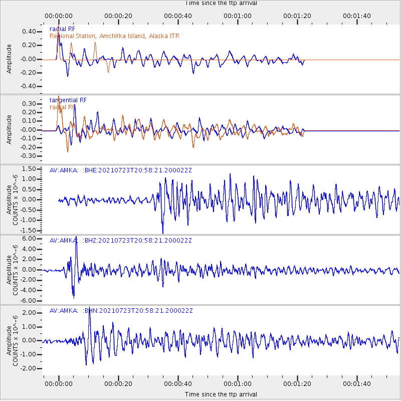
AMKA Regional Station, Amchitka Island, Alaska - Earthquake Result Viewer
*The percent match for this event was below the threshold and hence no stack was calculated.
| Earthquake location: |
Mindoro, Philippines |
| Earthquake latitude/longitude: |
13.7/120.7 |
| Earthquake time(UTC): |
2021/07/23 (204) 20:48:57 GMT |
| Earthquake Depth: |
110 km |
| Earthquake Magnitude: |
6.7 mww |
| Earthquake Catalog/Contributor: |
NEIC PDE/us |
|
| Network: |
AV Alaska Volcano Observatory |
| Station: |
AMKA Regional Station, Amchitka Island, Alaska |
| Lat/Lon: |
51.38 N/179.30 E |
| Elevation: |
116 m |
|
| Distance: |
59.9 deg |
| Az: |
38.166 deg |
| Baz: |
253.388 deg |
| Ray Param: |
$rayparam |
*The percent match for this event was below the threshold and hence was not used in the summary stack. |
|
| Radial Match: |
78.04603 % |
| Radial Bump: |
400 |
| Transverse Match: |
83.788216 % |
| Transverse Bump: |
400 |
| SOD ConfigId: |
25131211 |
| Insert Time: |
2021-08-06 20:55:12.933 +0000 |
| GWidth: |
2.5 |
| Max Bumps: |
400 |
| Tol: |
0.001 |
|
Signal To Noise
| Channel | StoN | STA | LTA |
| AV:AMKA: :BHZ:20210723T20:58:21.200022Z | 13.970319 | 1.2709432E-6 | 9.097454E-8 |
| AV:AMKA: :BHN:20210723T20:58:21.200022Z | 0.89158225 | 7.364811E-8 | 8.260383E-8 |
| AV:AMKA: :BHE:20210723T20:58:21.200022Z | 4.010576 | 3.760572E-7 | 9.376639E-8 |
| Arrivals |
| Ps | |
| PpPs | |
| PsPs/PpSs | |


