You are here: Home > Network List > G - GEOSCOPE Stations List
> Station FOMA Nahampoana reservation, Fort Dauphin, Madagascar > Earthquake Result Viewer
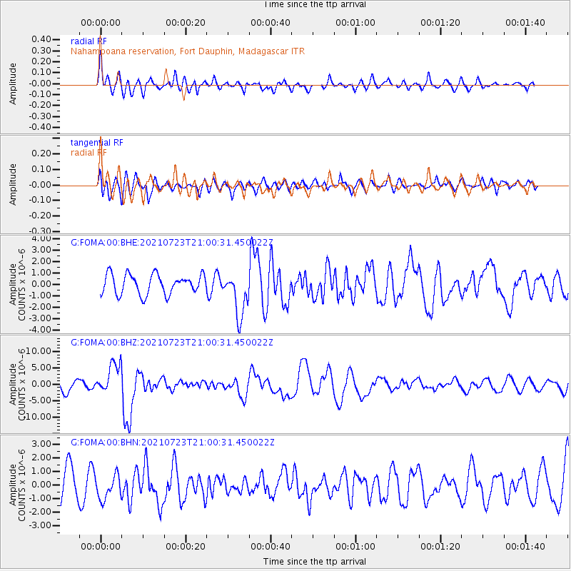
FOMA Nahampoana reservation, Fort Dauphin, Madagascar - Earthquake Result Viewer
*The percent match for this event was below the threshold and hence no stack was calculated.
| Earthquake location: |
Mindoro, Philippines |
| Earthquake latitude/longitude: |
13.7/120.7 |
| Earthquake time(UTC): |
2021/07/23 (204) 20:48:57 GMT |
| Earthquake Depth: |
110 km |
| Earthquake Magnitude: |
6.7 mww |
| Earthquake Catalog/Contributor: |
NEIC PDE/us |
|
| Network: |
G GEOSCOPE |
| Station: |
FOMA Nahampoana reservation, Fort Dauphin, Madagascar |
| Lat/Lon: |
24.98 S/46.98 E |
| Elevation: |
26 m |
|
| Distance: |
81.5 deg |
| Az: |
241.766 deg |
| Baz: |
70.643 deg |
| Ray Param: |
$rayparam |
*The percent match for this event was below the threshold and hence was not used in the summary stack. |
|
| Radial Match: |
66.98617 % |
| Radial Bump: |
400 |
| Transverse Match: |
53.520893 % |
| Transverse Bump: |
400 |
| SOD ConfigId: |
25131211 |
| Insert Time: |
2021-08-06 21:00:41.323 +0000 |
| GWidth: |
2.5 |
| Max Bumps: |
400 |
| Tol: |
0.001 |
|
Signal To Noise
| Channel | StoN | STA | LTA |
| G:FOMA:00:BHZ:20210723T21:00:31.450022Z | 2.8222523 | 4.892367E-6 | 1.7334976E-6 |
| G:FOMA:00:BHN:20210723T21:00:31.450022Z | 0.8214517 | 9.071066E-7 | 1.1042727E-6 |
| G:FOMA:00:BHE:20210723T21:00:31.450022Z | 2.3234234 | 2.0086434E-6 | 8.645188E-7 |
| Arrivals |
| Ps | |
| PpPs | |
| PsPs/PpSs | |


