You are here: Home > Network List > II - Global Seismograph Network (GSN - IRIS/IDA) Stations List
> Station ABPO Ambohimpanompo, Madagascar > Earthquake Result Viewer
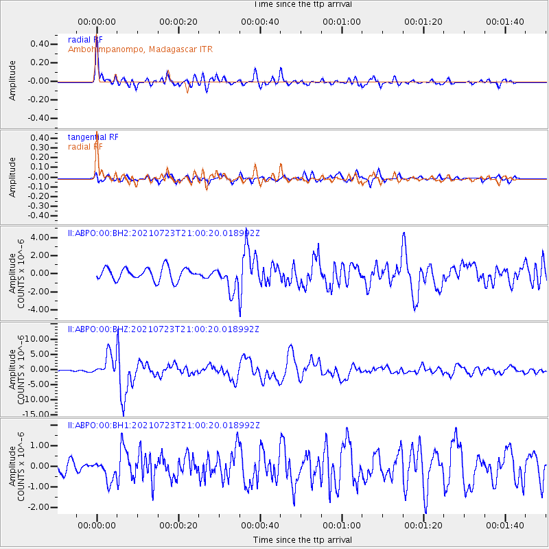
ABPO Ambohimpanompo, Madagascar - Earthquake Result Viewer

| Earthquake location: |
Mindoro, Philippines |
| Earthquake latitude/longitude: |
13.7/120.7 |
| Earthquake time(UTC): |
2021/07/23 (204) 20:48:57 GMT |
| Earthquake Depth: |
110 km |
| Earthquake Magnitude: |
6.7 mww |
| Earthquake Catalog/Contributor: |
NEIC PDE/us |
|
| Network: |
II Global Seismograph Network (GSN - IRIS/IDA) |
| Station: |
ABPO Ambohimpanompo, Madagascar |
| Lat/Lon: |
19.02 S/47.23 E |
| Elevation: |
1528 m |
|
| Distance: |
79.3 deg |
| Az: |
247.377 deg |
| Baz: |
71.484 deg |
| Ray Param: |
0.048771188 |
| Estimated Moho Depth: |
12.25 km |
| Estimated Crust Vp/Vs: |
1.61 |
| Assumed Crust Vp: |
6.642 km/s |
| Estimated Crust Vs: |
4.138 km/s |
| Estimated Crust Poisson's Ratio: |
0.18 |
|
| Radial Match: |
83.76981 % |
| Radial Bump: |
400 |
| Transverse Match: |
69.34727 % |
| Transverse Bump: |
400 |
| SOD ConfigId: |
25131211 |
| Insert Time: |
2021-08-06 21:02:12.144 +0000 |
| GWidth: |
2.5 |
| Max Bumps: |
400 |
| Tol: |
0.001 |
|
Signal To Noise
| Channel | StoN | STA | LTA |
| II:ABPO:00:BHZ:20210723T21:00:20.018992Z | 6.318607 | 3.8474586E-6 | 6.089093E-7 |
| II:ABPO:00:BH1:20210723T21:00:20.018992Z | 1.1933849 | 5.295136E-7 | 4.437073E-7 |
| II:ABPO:00:BH2:20210723T21:00:20.018992Z | 2.1046097 | 1.4478986E-6 | 6.879653E-7 |
| Arrivals |
| Ps | 1.2 SECOND |
| PpPs | 4.6 SECOND |
| PsPs/PpSs | 5.8 SECOND |


