You are here: Home > Network List > CI - Caltech Regional Seismic Network Stations List
> Station MPP McPhearson Peak > Earthquake Result Viewer
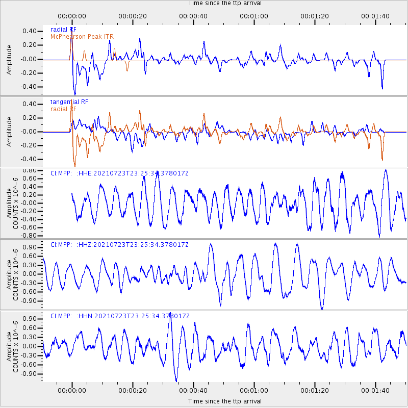
MPP McPhearson Peak - Earthquake Result Viewer
*The percent match for this event was below the threshold and hence no stack was calculated.
| Earthquake location: |
South Of Tonga Islands |
| Earthquake latitude/longitude: |
-26.6/-175.6 |
| Earthquake time(UTC): |
2021/07/23 (204) 23:13:52 GMT |
| Earthquake Depth: |
10 km |
| Earthquake Magnitude: |
5.5 mb |
| Earthquake Catalog/Contributor: |
NEIC PDE/us |
|
| Network: |
CI Caltech Regional Seismic Network |
| Station: |
MPP McPhearson Peak |
| Lat/Lon: |
34.89 N/119.81 W |
| Elevation: |
1739 m |
|
| Distance: |
80.8 deg |
| Az: |
43.511 deg |
| Baz: |
228.566 deg |
| Ray Param: |
$rayparam |
*The percent match for this event was below the threshold and hence was not used in the summary stack. |
|
| Radial Match: |
72.29403 % |
| Radial Bump: |
400 |
| Transverse Match: |
50.926487 % |
| Transverse Bump: |
400 |
| SOD ConfigId: |
25131211 |
| Insert Time: |
2021-08-06 23:20:06.589 +0000 |
| GWidth: |
2.5 |
| Max Bumps: |
400 |
| Tol: |
0.001 |
|
Signal To Noise
| Channel | StoN | STA | LTA |
| CI:MPP: :HHZ:20210723T23:25:34.378017Z | 0.6621411 | 2.8016382E-7 | 4.23118E-7 |
| CI:MPP: :HHN:20210723T23:25:34.378017Z | 0.92731917 | 3.6404555E-7 | 3.9257847E-7 |
| CI:MPP: :HHE:20210723T23:25:34.378017Z | 1.2978985 | 3.6993066E-7 | 2.850228E-7 |
| Arrivals |
| Ps | |
| PpPs | |
| PsPs/PpSs | |


