You are here: Home > Network List > CI - Caltech Regional Seismic Network Stations List
> Station MUR Murrieta > Earthquake Result Viewer
MUR Murrieta - Earthquake Result Viewer
*The percent match for this event was below the threshold and hence no stack was calculated.
| Earthquake location: |
South Of Tonga Islands |
| Earthquake latitude/longitude: |
-26.6/-175.6 |
| Earthquake time(UTC): |
2021/07/23 (204) 23:13:52 GMT |
| Earthquake Depth: |
10 km |
| Earthquake Magnitude: |
5.5 mb |
| Earthquake Catalog/Contributor: |
NEIC PDE/us |
|
| Network: |
CI Caltech Regional Seismic Network |
| Station: |
MUR Murrieta |
| Lat/Lon: |
33.60 N/117.20 W |
| Elevation: |
562 m |
|
| Distance: |
81.6 deg |
| Az: |
45.926 deg |
| Baz: |
230.403 deg |
| Ray Param: |
$rayparam |
*The percent match for this event was below the threshold and hence was not used in the summary stack. |
|
| Radial Match: |
71.527115 % |
| Radial Bump: |
400 |
| Transverse Match: |
61.88768 % |
| Transverse Bump: |
400 |
| SOD ConfigId: |
25131211 |
| Insert Time: |
2021-08-06 23:20:08.690 +0000 |
| GWidth: |
2.5 |
| Max Bumps: |
400 |
| Tol: |
0.001 |
|
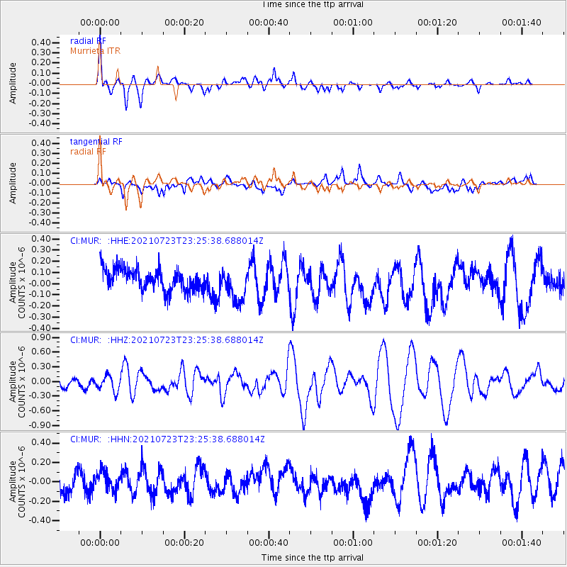
Signal To Noise
| Channel | StoN | STA | LTA |
| CI:MUR: :HHZ:20210723T23:25:38.688014Z | 1.888299 | 1.5902198E-7 | 8.421441E-8 |
| CI:MUR: :HHN:20210723T23:25:38.688014Z | 0.83759004 | 9.831547E-8 | 1.1737899E-7 |
| CI:MUR: :HHE:20210723T23:25:38.688014Z | 1.591989 | 1.5254817E-7 | 9.582237E-8 |
| Arrivals |
| Ps | |
| PpPs | |
| PsPs/PpSs | |


