You are here: Home > Network List > G - GEOSCOPE Stations List
> Station INU Inuyama, Japan > Earthquake Result Viewer
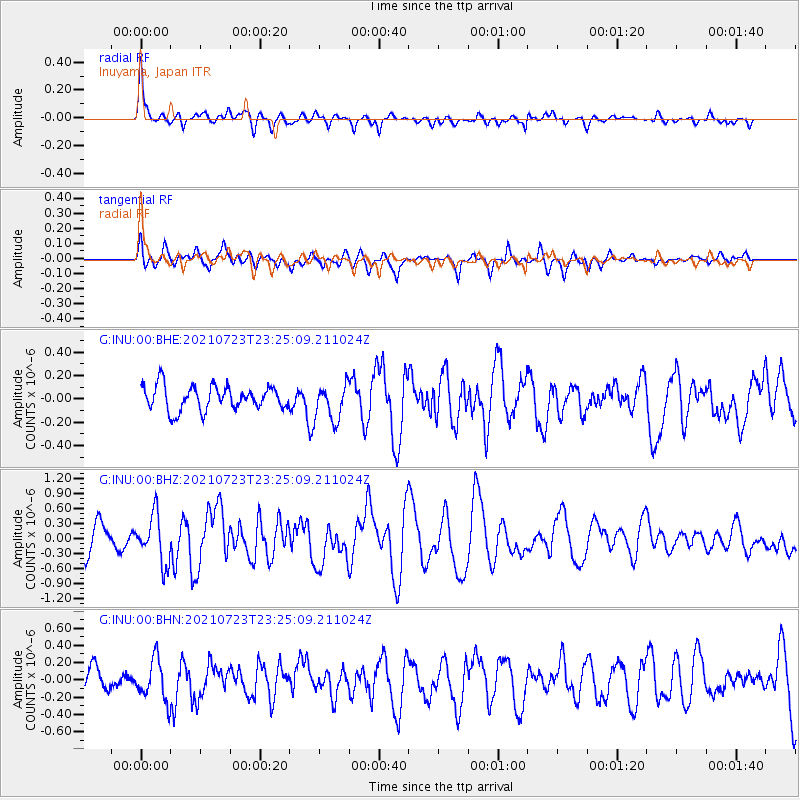
INU Inuyama, Japan - Earthquake Result Viewer
*The percent match for this event was below the threshold and hence no stack was calculated.
| Earthquake location: |
South Of Tonga Islands |
| Earthquake latitude/longitude: |
-26.6/-175.6 |
| Earthquake time(UTC): |
2021/07/23 (204) 23:13:52 GMT |
| Earthquake Depth: |
10 km |
| Earthquake Magnitude: |
5.5 mb |
| Earthquake Catalog/Contributor: |
NEIC PDE/us |
|
| Network: |
G GEOSCOPE |
| Station: |
INU Inuyama, Japan |
| Lat/Lon: |
35.35 N/137.03 E |
| Elevation: |
132 m |
|
| Distance: |
76.2 deg |
| Az: |
321.714 deg |
| Baz: |
137.274 deg |
| Ray Param: |
$rayparam |
*The percent match for this event was below the threshold and hence was not used in the summary stack. |
|
| Radial Match: |
72.73454 % |
| Radial Bump: |
400 |
| Transverse Match: |
64.278336 % |
| Transverse Bump: |
400 |
| SOD ConfigId: |
25131211 |
| Insert Time: |
2021-08-06 23:21:38.219 +0000 |
| GWidth: |
2.5 |
| Max Bumps: |
400 |
| Tol: |
0.001 |
|
Signal To Noise
| Channel | StoN | STA | LTA |
| G:INU:00:BHZ:20210723T23:25:09.211024Z | 2.3982337 | 4.8105113E-7 | 2.005856E-7 |
| G:INU:00:BHN:20210723T23:25:09.211024Z | 1.7530473 | 2.3926287E-7 | 1.3648399E-7 |
| G:INU:00:BHE:20210723T23:25:09.211024Z | 1.5062305 | 1.5597759E-7 | 1.03554925E-7 |
| Arrivals |
| Ps | |
| PpPs | |
| PsPs/PpSs | |


