You are here: Home > Network List > IW - Intermountain West Stations List
> Station PLID Pearl Lake, Idaho, USA > Earthquake Result Viewer
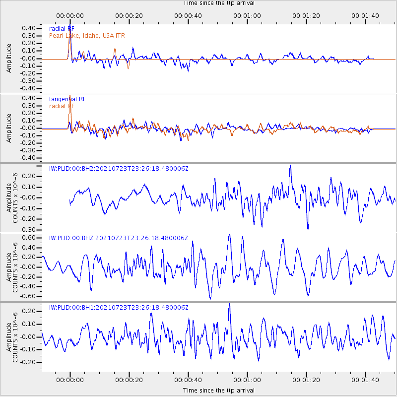
PLID Pearl Lake, Idaho, USA - Earthquake Result Viewer
*The percent match for this event was below the threshold and hence no stack was calculated.
| Earthquake location: |
South Of Tonga Islands |
| Earthquake latitude/longitude: |
-26.6/-175.6 |
| Earthquake time(UTC): |
2021/07/23 (204) 23:13:52 GMT |
| Earthquake Depth: |
10 km |
| Earthquake Magnitude: |
5.5 mb |
| Earthquake Catalog/Contributor: |
NEIC PDE/us |
|
| Network: |
IW Intermountain West |
| Station: |
PLID Pearl Lake, Idaho, USA |
| Lat/Lon: |
45.09 N/116.00 W |
| Elevation: |
2164 m |
|
| Distance: |
89.6 deg |
| Az: |
37.651 deg |
| Baz: |
230.525 deg |
| Ray Param: |
$rayparam |
*The percent match for this event was below the threshold and hence was not used in the summary stack. |
|
| Radial Match: |
77.003555 % |
| Radial Bump: |
400 |
| Transverse Match: |
62.7268 % |
| Transverse Bump: |
400 |
| SOD ConfigId: |
25131211 |
| Insert Time: |
2021-08-06 23:22:43.483 +0000 |
| GWidth: |
2.5 |
| Max Bumps: |
400 |
| Tol: |
0.001 |
|
Signal To Noise
| Channel | StoN | STA | LTA |
| IW:PLID:00:BHZ:20210723T23:26:18.480006Z | 2.245193 | 1.5643359E-7 | 6.967489E-8 |
| IW:PLID:00:BH1:20210723T23:26:18.480006Z | 1.0557811 | 4.8616478E-8 | 4.6047877E-8 |
| IW:PLID:00:BH2:20210723T23:26:18.480006Z | 0.5155728 | 3.2277047E-8 | 6.260425E-8 |
| Arrivals |
| Ps | |
| PpPs | |
| PsPs/PpSs | |


