You are here: Home > Network List > C8 - Canadian Seismic Research Network () Stations List
> Station GRIB Gribbell Island, BC, CA > Earthquake Result Viewer
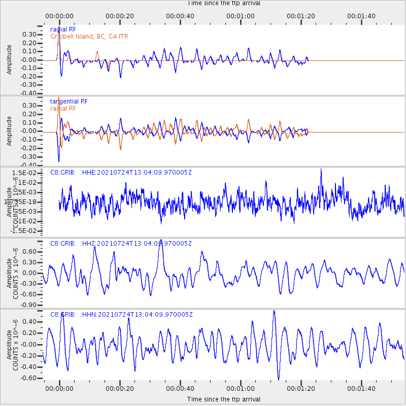
GRIB Gribbell Island, BC, CA - Earthquake Result Viewer
*The percent match for this event was below the threshold and hence no stack was calculated.
| Earthquake location: |
Kermadec Islands Region |
| Earthquake latitude/longitude: |
-30.0/-176.9 |
| Earthquake time(UTC): |
2021/07/24 (205) 12:51:28 GMT |
| Earthquake Depth: |
7.0 km |
| Earthquake Magnitude: |
6.1 mww |
| Earthquake Catalog/Contributor: |
NEIC PDE/us |
|
| Network: |
C8 Canadian Seismic Research Network () |
| Station: |
GRIB Gribbell Island, BC, CA |
| Lat/Lon: |
53.34 N/129.14 W |
| Elevation: |
418 m |
|
| Distance: |
92.8 deg |
| Az: |
26.402 deg |
| Baz: |
220.051 deg |
| Ray Param: |
$rayparam |
*The percent match for this event was below the threshold and hence was not used in the summary stack. |
|
| Radial Match: |
56.334557 % |
| Radial Bump: |
377 |
| Transverse Match: |
56.47052 % |
| Transverse Bump: |
400 |
| SOD ConfigId: |
25131211 |
| Insert Time: |
2021-08-07 12:57:00.009 +0000 |
| GWidth: |
2.5 |
| Max Bumps: |
400 |
| Tol: |
0.001 |
|
Signal To Noise
| Channel | StoN | STA | LTA |
| C8:GRIB: :HHZ:20210724T13:04:09.970005Z | 2.7572877 | 2.397263E-7 | 8.694279E-8 |
| C8:GRIB: :HHN:20210724T13:04:09.970005Z | 1.9250376 | 3.3081523E-7 | 1.7184871E-7 |
| C8:GRIB: :HHE:20210724T13:04:09.970005Z | 0.97581375 | 3.6988161E-9 | 3.790494E-9 |
| Arrivals |
| Ps | |
| PpPs | |
| PsPs/PpSs | |


