You are here: Home > Network List > UU - University of Utah Regional Network Stations List
> Station CCUT Cedar City, UT, USA > Earthquake Result Viewer
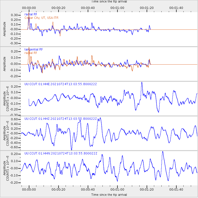
CCUT Cedar City, UT, USA - Earthquake Result Viewer
*The percent match for this event was below the threshold and hence no stack was calculated.
| Earthquake location: |
Kermadec Islands Region |
| Earthquake latitude/longitude: |
-30.0/-176.9 |
| Earthquake time(UTC): |
2021/07/24 (205) 12:51:28 GMT |
| Earthquake Depth: |
7.0 km |
| Earthquake Magnitude: |
6.1 mww |
| Earthquake Catalog/Contributor: |
NEIC PDE/us |
|
| Network: |
UU University of Utah Regional Network |
| Station: |
CCUT Cedar City, UT, USA |
| Lat/Lon: |
37.55 N/113.36 W |
| Elevation: |
2127 m |
|
| Distance: |
89.7 deg |
| Az: |
45.373 deg |
| Baz: |
230.989 deg |
| Ray Param: |
$rayparam |
*The percent match for this event was below the threshold and hence was not used in the summary stack. |
|
| Radial Match: |
65.817764 % |
| Radial Bump: |
400 |
| Transverse Match: |
69.47762 % |
| Transverse Bump: |
400 |
| SOD ConfigId: |
25131211 |
| Insert Time: |
2021-08-07 13:06:13.362 +0000 |
| GWidth: |
2.5 |
| Max Bumps: |
400 |
| Tol: |
0.001 |
|
Signal To Noise
| Channel | StoN | STA | LTA |
| UU:CCUT:01:HHZ:20210724T13:03:55.800022Z | 0.8572585 | 4.5457927E-8 | 5.3027094E-8 |
| UU:CCUT:01:HHN:20210724T13:03:55.800022Z | 1.59659 | 5.5619804E-8 | 3.483662E-8 |
| UU:CCUT:01:HHE:20210724T13:03:55.800022Z | 0.87661475 | 5.0959915E-8 | 5.8132624E-8 |
| Arrivals |
| Ps | |
| PpPs | |
| PsPs/PpSs | |


