You are here: Home > Network List > US - United States National Seismic Network Stations List
> Station VBMS Vicksburg, Mississippi > Earthquake Result Viewer
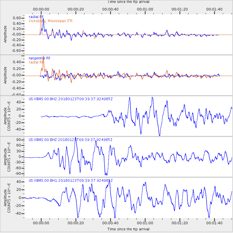
VBMS Vicksburg, Mississippi - Earthquake Result Viewer
*The percent match for this event was below the threshold and hence no stack was calculated.
| Earthquake location: |
Gulf Of Alaska |
| Earthquake latitude/longitude: |
56.0/-149.1 |
| Earthquake time(UTC): |
2018/01/23 (023) 09:31:42 GMT |
| Earthquake Depth: |
25 km |
| Earthquake Magnitude: |
7.9 Mww |
| Earthquake Catalog/Contributor: |
NEIC PDE/us |
|
| Network: |
US United States National Seismic Network |
| Station: |
VBMS Vicksburg, Mississippi |
| Lat/Lon: |
32.22 N/90.52 W |
| Elevation: |
16 m |
|
| Distance: |
46.6 deg |
| Az: |
95.396 deg |
| Baz: |
318.774 deg |
| Ray Param: |
$rayparam |
*The percent match for this event was below the threshold and hence was not used in the summary stack. |
|
| Radial Match: |
96.13098 % |
| Radial Bump: |
400 |
| Transverse Match: |
92.77686 % |
| Transverse Bump: |
400 |
| SOD ConfigId: |
2546091 |
| Insert Time: |
2018-02-06 09:38:38.629 +0000 |
| GWidth: |
2.5 |
| Max Bumps: |
400 |
| Tol: |
0.001 |
|
Signal To Noise
| Channel | StoN | STA | LTA |
| US:VBMS:00:BHZ:20180123T09:39:37.924985Z | 18.42567 | 1.0638961E-5 | 5.773988E-7 |
| US:VBMS:00:BH1:20180123T09:39:37.924985Z | 2.6055064 | 3.0128565E-6 | 1.156342E-6 |
| US:VBMS:00:BH2:20180123T09:39:37.924985Z | 2.2228475 | 2.407528E-6 | 1.0830829E-6 |
| Arrivals |
| Ps | |
| PpPs | |
| PsPs/PpSs | |


