You are here: Home > Network List > AK - Alaska Regional Network Stations List
> Station MDM Murphy Dome > Earthquake Result Viewer
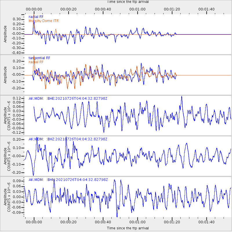
MDM Murphy Dome - Earthquake Result Viewer
*The percent match for this event was below the threshold and hence no stack was calculated.
| Earthquake location: |
Minahassa Peninsula, Sulawesi |
| Earthquake latitude/longitude: |
-0.7/121.9 |
| Earthquake time(UTC): |
2021/07/26 (207) 03:52:03 GMT |
| Earthquake Depth: |
15 km |
| Earthquake Magnitude: |
5.8 Mww |
| Earthquake Catalog/Contributor: |
NEIC PDE/us |
|
| Network: |
AK Alaska Regional Network |
| Station: |
MDM Murphy Dome |
| Lat/Lon: |
64.96 N/148.23 W |
| Elevation: |
634 m |
|
| Distance: |
90.6 deg |
| Az: |
25.19 deg |
| Baz: |
269.569 deg |
| Ray Param: |
$rayparam |
*The percent match for this event was below the threshold and hence was not used in the summary stack. |
|
| Radial Match: |
58.16652 % |
| Radial Bump: |
400 |
| Transverse Match: |
54.676 % |
| Transverse Bump: |
400 |
| SOD ConfigId: |
25131211 |
| Insert Time: |
2021-08-09 03:54:39.793 +0000 |
| GWidth: |
2.5 |
| Max Bumps: |
400 |
| Tol: |
0.001 |
|
Signal To Noise
| Channel | StoN | STA | LTA |
| AK:MDM: :BHZ:20210726T04:04:32.82798Z | 4.675617 | 1.309663E-7 | 2.8010486E-8 |
| AK:MDM: :BHN:20210726T04:04:32.82798Z | 0.64764816 | 2.849283E-8 | 4.3994305E-8 |
| AK:MDM: :BHE:20210726T04:04:32.82798Z | 1.3389128 | 4.7159673E-8 | 3.5222364E-8 |
| Arrivals |
| Ps | |
| PpPs | |
| PsPs/PpSs | |


