You are here: Home > Network List > IU - Global Seismograph Network (GSN - IRIS/USGS) Stations List
> Station RSSD Black Hills, South Dakota, USA > Earthquake Result Viewer
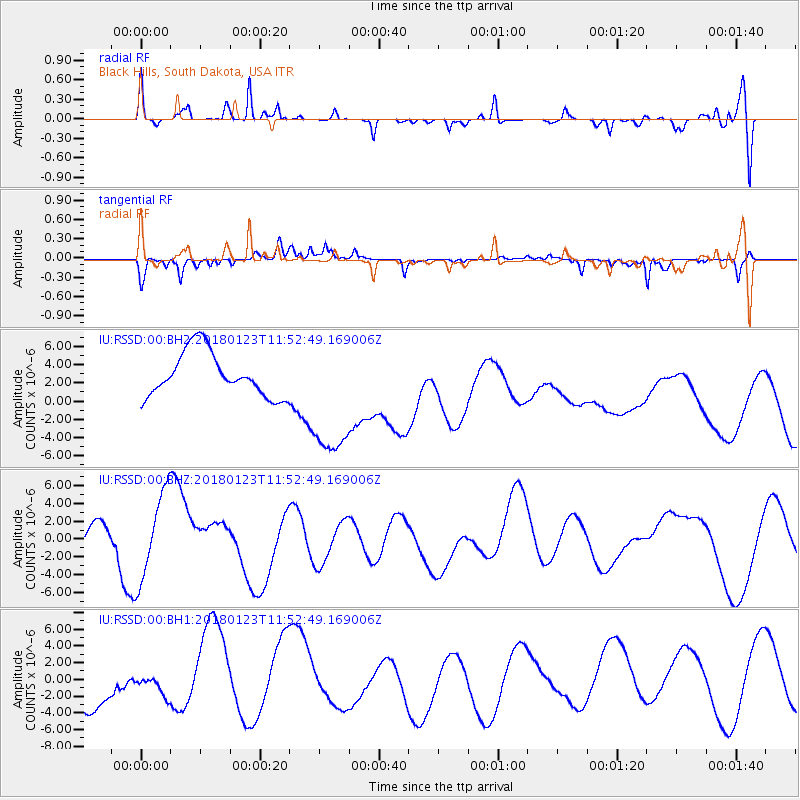
RSSD Black Hills, South Dakota, USA - Earthquake Result Viewer
*The percent match for this event was below the threshold and hence no stack was calculated.
| Earthquake location: |
Gulf Of Alaska |
| Earthquake latitude/longitude: |
56.6/-149.1 |
| Earthquake time(UTC): |
2018/01/23 (023) 11:47:03 GMT |
| Earthquake Depth: |
4.9 km |
| Earthquake Magnitude: |
5.6 mb |
| Earthquake Catalog/Contributor: |
NEIC PDE/ak |
|
| Network: |
IU Global Seismograph Network (GSN - IRIS/USGS) |
| Station: |
RSSD Black Hills, South Dakota, USA |
| Lat/Lon: |
44.12 N/104.04 W |
| Elevation: |
2090 m |
|
| Distance: |
30.8 deg |
| Az: |
94.412 deg |
| Baz: |
309.985 deg |
| Ray Param: |
$rayparam |
*The percent match for this event was below the threshold and hence was not used in the summary stack. |
|
| Radial Match: |
61.376713 % |
| Radial Bump: |
400 |
| Transverse Match: |
60.758068 % |
| Transverse Bump: |
256 |
| SOD ConfigId: |
2546091 |
| Insert Time: |
2018-02-06 11:48:55.124 +0000 |
| GWidth: |
2.5 |
| Max Bumps: |
400 |
| Tol: |
0.001 |
|
Signal To Noise
| Channel | StoN | STA | LTA |
| IU:RSSD:00:BHZ:20180123T11:52:49.169006Z | 2.9204607 | 4.941903E-6 | 1.6921656E-6 |
| IU:RSSD:00:BH1:20180123T11:52:49.169006Z | 0.47088206 | 1.10287E-6 | 2.3421364E-6 |
| IU:RSSD:00:BH2:20180123T11:52:49.169006Z | 3.062842 | 7.4181726E-6 | 2.42199E-6 |
| Arrivals |
| Ps | |
| PpPs | |
| PsPs/PpSs | |


