You are here: Home > Network List > NM - Cooperative New Madrid Seismic Network Stations List
> Station UTMT Martin, TN > Earthquake Result Viewer
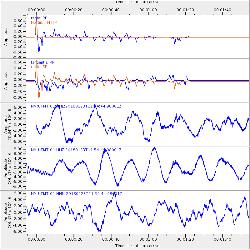
UTMT Martin, TN - Earthquake Result Viewer
*The percent match for this event was below the threshold and hence no stack was calculated.
| Earthquake location: |
Gulf Of Alaska |
| Earthquake latitude/longitude: |
56.6/-149.1 |
| Earthquake time(UTC): |
2018/01/23 (023) 11:47:03 GMT |
| Earthquake Depth: |
4.9 km |
| Earthquake Magnitude: |
5.6 mb |
| Earthquake Catalog/Contributor: |
NEIC PDE/ak |
|
| Network: |
NM Cooperative New Madrid Seismic Network |
| Station: |
UTMT Martin, TN |
| Lat/Lon: |
36.35 N/88.86 W |
| Elevation: |
110 m |
|
| Distance: |
44.5 deg |
| Az: |
90.549 deg |
| Baz: |
316.722 deg |
| Ray Param: |
$rayparam |
*The percent match for this event was below the threshold and hence was not used in the summary stack. |
|
| Radial Match: |
69.70898 % |
| Radial Bump: |
400 |
| Transverse Match: |
76.12405 % |
| Transverse Bump: |
400 |
| SOD ConfigId: |
2546091 |
| Insert Time: |
2018-02-06 11:49:40.366 +0000 |
| GWidth: |
2.5 |
| Max Bumps: |
400 |
| Tol: |
0.001 |
|
Signal To Noise
| Channel | StoN | STA | LTA |
| NM:UTMT:01:HHZ:20180123T11:54:44.98001Z | 0.6225744 | 1.9777492E-6 | 3.1767274E-6 |
| NM:UTMT:01:HHN:20180123T11:54:44.98001Z | 0.61420304 | 1.237044E-6 | 2.0140635E-6 |
| NM:UTMT:01:HHE:20180123T11:54:44.98001Z | 1.4108201 | 5.235381E-6 | 3.710878E-6 |
| Arrivals |
| Ps | |
| PpPs | |
| PsPs/PpSs | |


