You are here: Home > Network List > US - United States National Seismic Network Stations List
> Station AMTX Amarillo, Texas, USA > Earthquake Result Viewer
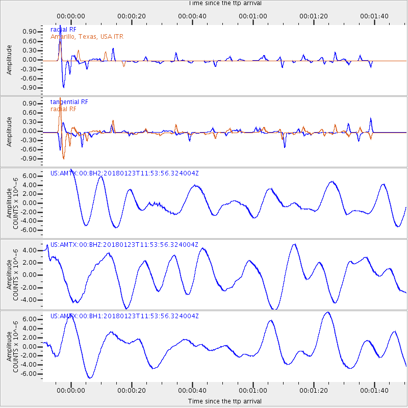
AMTX Amarillo, Texas, USA - Earthquake Result Viewer
*The percent match for this event was below the threshold and hence no stack was calculated.
| Earthquake location: |
Gulf Of Alaska |
| Earthquake latitude/longitude: |
56.6/-149.1 |
| Earthquake time(UTC): |
2018/01/23 (023) 11:47:03 GMT |
| Earthquake Depth: |
4.9 km |
| Earthquake Magnitude: |
5.6 mb |
| Earthquake Catalog/Contributor: |
NEIC PDE/ak |
|
| Network: |
US United States National Seismic Network |
| Station: |
AMTX Amarillo, Texas, USA |
| Lat/Lon: |
34.53 N/101.41 W |
| Elevation: |
1010 m |
|
| Distance: |
39.0 deg |
| Az: |
103.808 deg |
| Baz: |
319.382 deg |
| Ray Param: |
$rayparam |
*The percent match for this event was below the threshold and hence was not used in the summary stack. |
|
| Radial Match: |
67.296814 % |
| Radial Bump: |
400 |
| Transverse Match: |
70.24699 % |
| Transverse Bump: |
350 |
| SOD ConfigId: |
2546091 |
| Insert Time: |
2018-02-06 11:50:14.619 +0000 |
| GWidth: |
2.5 |
| Max Bumps: |
400 |
| Tol: |
0.001 |
|
Signal To Noise
| Channel | StoN | STA | LTA |
| US:AMTX:00:BHZ:20180123T11:53:56.324004Z | 1.4017099 | 3.8698417E-6 | 2.7608007E-6 |
| US:AMTX:00:BH1:20180123T11:53:56.324004Z | 1.8339899 | 4.973838E-6 | 2.7120311E-6 |
| US:AMTX:00:BH2:20180123T11:53:56.324004Z | 0.47402012 | 1.4644414E-6 | 3.0894078E-6 |
| Arrivals |
| Ps | |
| PpPs | |
| PsPs/PpSs | |


