You are here: Home > Network List > US - United States National Seismic Network Stations List
> Station HDIL Hopedale, Illinois, USA > Earthquake Result Viewer
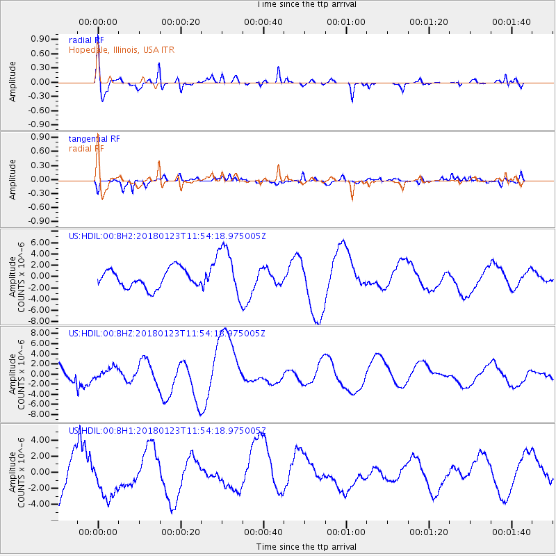
HDIL Hopedale, Illinois, USA - Earthquake Result Viewer
*The percent match for this event was below the threshold and hence no stack was calculated.
| Earthquake location: |
Gulf Of Alaska |
| Earthquake latitude/longitude: |
56.6/-149.1 |
| Earthquake time(UTC): |
2018/01/23 (023) 11:47:03 GMT |
| Earthquake Depth: |
4.9 km |
| Earthquake Magnitude: |
5.6 mb |
| Earthquake Catalog/Contributor: |
NEIC PDE/ak |
|
| Network: |
US United States National Seismic Network |
| Station: |
HDIL Hopedale, Illinois, USA |
| Lat/Lon: |
40.56 N/89.29 W |
| Elevation: |
219 m |
|
| Distance: |
41.3 deg |
| Az: |
86.549 deg |
| Baz: |
313.523 deg |
| Ray Param: |
$rayparam |
*The percent match for this event was below the threshold and hence was not used in the summary stack. |
|
| Radial Match: |
72.55225 % |
| Radial Bump: |
387 |
| Transverse Match: |
58.131046 % |
| Transverse Bump: |
346 |
| SOD ConfigId: |
2546091 |
| Insert Time: |
2018-02-06 11:50:22.619 +0000 |
| GWidth: |
2.5 |
| Max Bumps: |
400 |
| Tol: |
0.001 |
|
Signal To Noise
| Channel | StoN | STA | LTA |
| US:HDIL:00:BHZ:20180123T11:54:18.975005Z | 0.2677054 | 8.7388327E-7 | 3.2643466E-6 |
| US:HDIL:00:BH1:20180123T11:54:18.975005Z | 1.3639964 | 2.783269E-6 | 2.0405253E-6 |
| US:HDIL:00:BH2:20180123T11:54:18.975005Z | 2.782835 | 4.5322163E-6 | 1.6286328E-6 |
| Arrivals |
| Ps | |
| PpPs | |
| PsPs/PpSs | |


