You are here: Home > Network List > AV - Alaska Volcano Observatory Stations List
> Station TANO North, Tanaga Volcano, Alaska > Earthquake Result Viewer
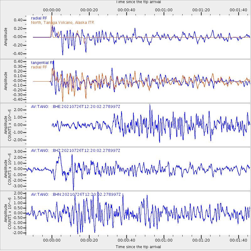
TANO North, Tanaga Volcano, Alaska - Earthquake Result Viewer
*The percent match for this event was below the threshold and hence no stack was calculated.
| Earthquake location: |
Minahassa Peninsula, Sulawesi |
| Earthquake latitude/longitude: |
-0.7/121.9 |
| Earthquake time(UTC): |
2021/07/26 (207) 12:09:06 GMT |
| Earthquake Depth: |
11 km |
| Earthquake Magnitude: |
6.2 mww |
| Earthquake Catalog/Contributor: |
NEIC PDE/us |
|
| Network: |
AV Alaska Volcano Observatory |
| Station: |
TANO North, Tanaga Volcano, Alaska |
| Lat/Lon: |
51.91 N/178.12 W |
| Elevation: |
269 m |
|
| Distance: |
72.5 deg |
| Az: |
34.195 deg |
| Baz: |
245.131 deg |
| Ray Param: |
$rayparam |
*The percent match for this event was below the threshold and hence was not used in the summary stack. |
|
| Radial Match: |
70.58908 % |
| Radial Bump: |
400 |
| Transverse Match: |
74.464935 % |
| Transverse Bump: |
400 |
| SOD ConfigId: |
25131211 |
| Insert Time: |
2021-08-09 12:16:32.345 +0000 |
| GWidth: |
2.5 |
| Max Bumps: |
400 |
| Tol: |
0.001 |
|
Signal To Noise
| Channel | StoN | STA | LTA |
| AV:TANO: :BHZ:20210726T12:20:02.278997Z | 8.21625 | 1.4268388E-6 | 1.7366058E-7 |
| AV:TANO: :BHN:20210726T12:20:02.278997Z | 1.7950704 | 4.3846174E-7 | 2.4425879E-7 |
| AV:TANO: :BHE:20210726T12:20:02.278997Z | 2.4531386 | 6.5245274E-7 | 2.6596652E-7 |
| Arrivals |
| Ps | |
| PpPs | |
| PsPs/PpSs | |


