You are here: Home > Network List > G - GEOSCOPE Stations List
> Station INU Inuyama, Japan > Earthquake Result Viewer
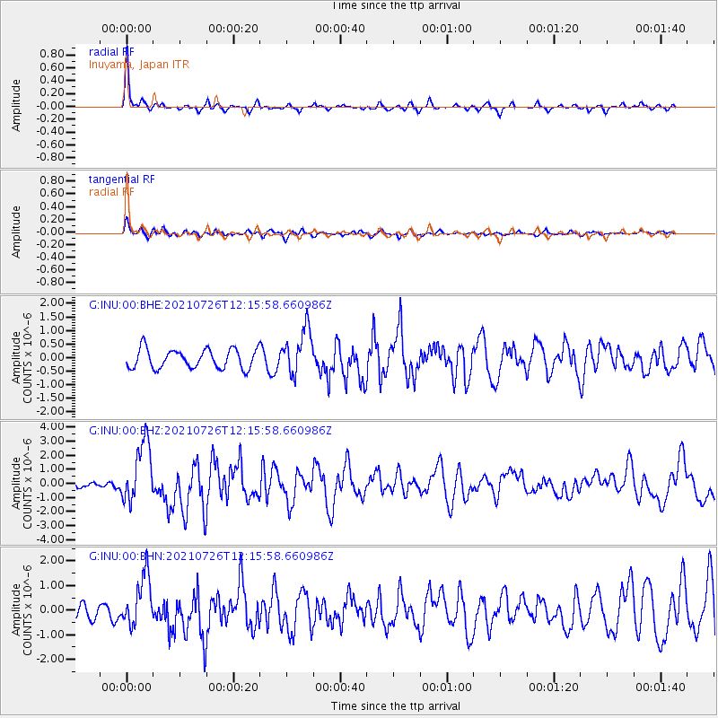
INU Inuyama, Japan - Earthquake Result Viewer
*The percent match for this event was below the threshold and hence no stack was calculated.
| Earthquake location: |
Minahassa Peninsula, Sulawesi |
| Earthquake latitude/longitude: |
-0.7/121.9 |
| Earthquake time(UTC): |
2021/07/26 (207) 12:09:06 GMT |
| Earthquake Depth: |
11 km |
| Earthquake Magnitude: |
6.2 mww |
| Earthquake Catalog/Contributor: |
NEIC PDE/us |
|
| Network: |
G GEOSCOPE |
| Station: |
INU Inuyama, Japan |
| Lat/Lon: |
35.35 N/137.03 E |
| Elevation: |
132 m |
|
| Distance: |
38.6 deg |
| Az: |
19.963 deg |
| Baz: |
204.684 deg |
| Ray Param: |
$rayparam |
*The percent match for this event was below the threshold and hence was not used in the summary stack. |
|
| Radial Match: |
78.114204 % |
| Radial Bump: |
265 |
| Transverse Match: |
66.54927 % |
| Transverse Bump: |
400 |
| SOD ConfigId: |
25131211 |
| Insert Time: |
2021-08-09 12:17:29.753 +0000 |
| GWidth: |
2.5 |
| Max Bumps: |
400 |
| Tol: |
0.001 |
|
Signal To Noise
| Channel | StoN | STA | LTA |
| G:INU:00:BHZ:20210726T12:15:58.660986Z | 7.2008767 | 2.1627584E-6 | 3.0034653E-7 |
| G:INU:00:BHN:20210726T12:15:58.660986Z | 3.4499085 | 1.0448558E-6 | 3.028648E-7 |
| G:INU:00:BHE:20210726T12:15:58.660986Z | 2.368744 | 8.380609E-7 | 3.5379972E-7 |
| Arrivals |
| Ps | |
| PpPs | |
| PsPs/PpSs | |


