You are here: Home > Network List > GS - US Geological Survey Networks Stations List
> Station KAN10 Keim Farm > Earthquake Result Viewer
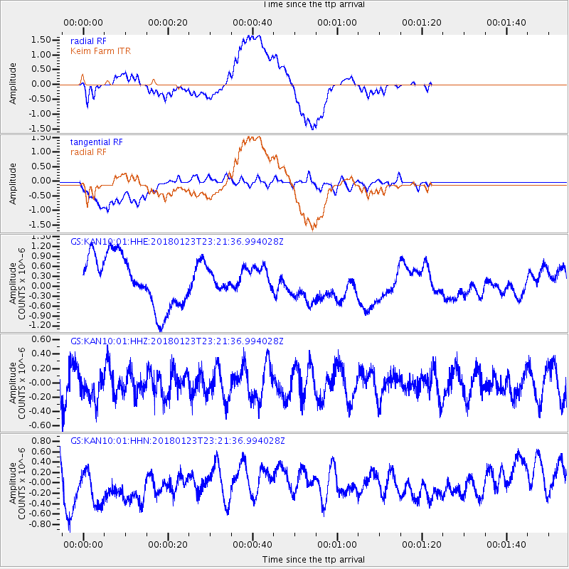
KAN10 Keim Farm - Earthquake Result Viewer
*The percent match for this event was below the threshold and hence no stack was calculated.
| Earthquake location: |
Ascension Island Region |
| Earthquake latitude/longitude: |
-5.8/-12.5 |
| Earthquake time(UTC): |
2018/01/23 (023) 23:09:09 GMT |
| Earthquake Depth: |
10 km |
| Earthquake Magnitude: |
5.6 mb |
| Earthquake Catalog/Contributor: |
NEIC PDE/us |
|
| Network: |
GS US Geological Survey Networks |
| Station: |
KAN10 Keim Farm |
| Lat/Lon: |
37.12 N/98.10 W |
| Elevation: |
417 m |
|
| Distance: |
89.9 deg |
| Az: |
307.168 deg |
| Baz: |
97.241 deg |
| Ray Param: |
$rayparam |
*The percent match for this event was below the threshold and hence was not used in the summary stack. |
|
| Radial Match: |
44.987762 % |
| Radial Bump: |
400 |
| Transverse Match: |
55.35677 % |
| Transverse Bump: |
400 |
| SOD ConfigId: |
2546091 |
| Insert Time: |
2018-02-06 23:10:13.794 +0000 |
| GWidth: |
2.5 |
| Max Bumps: |
400 |
| Tol: |
0.001 |
|
Signal To Noise
| Channel | StoN | STA | LTA |
| GS:KAN10:01:HHZ:20180123T23:21:36.994028Z | 0.8238608 | 1.7937327E-7 | 2.1772279E-7 |
| GS:KAN10:01:HHN:20180123T23:21:36.994028Z | 1.7137877 | 5.047079E-7 | 2.9449848E-7 |
| GS:KAN10:01:HHE:20180123T23:21:36.994028Z | 0.3170689 | 2.4457708E-7 | 7.713689E-7 |
| Arrivals |
| Ps | |
| PpPs | |
| PsPs/PpSs | |


