You are here: Home > Network List > TA - USArray Transportable Network (new EarthScope stations) Stations List
> Station TUL3 Leonard, OK, USA > Earthquake Result Viewer
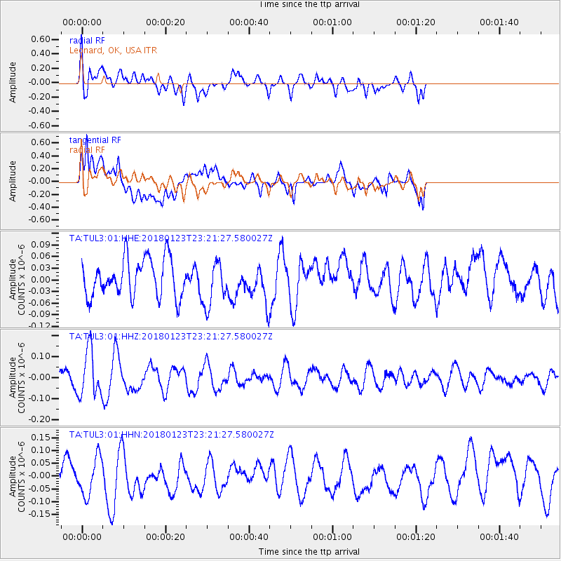
TUL3 Leonard, OK, USA - Earthquake Result Viewer
*The percent match for this event was below the threshold and hence no stack was calculated.
| Earthquake location: |
Ascension Island Region |
| Earthquake latitude/longitude: |
-5.8/-12.5 |
| Earthquake time(UTC): |
2018/01/23 (023) 23:09:09 GMT |
| Earthquake Depth: |
10 km |
| Earthquake Magnitude: |
5.6 mb |
| Earthquake Catalog/Contributor: |
NEIC PDE/us |
|
| Network: |
TA USArray Transportable Network (new EarthScope stations) |
| Station: |
TUL3 Leonard, OK, USA |
| Lat/Lon: |
35.91 N/95.79 W |
| Elevation: |
265 m |
|
| Distance: |
87.9 deg |
| Az: |
306.224 deg |
| Baz: |
98.588 deg |
| Ray Param: |
$rayparam |
*The percent match for this event was below the threshold and hence was not used in the summary stack. |
|
| Radial Match: |
52.010853 % |
| Radial Bump: |
400 |
| Transverse Match: |
67.37915 % |
| Transverse Bump: |
400 |
| SOD ConfigId: |
2546091 |
| Insert Time: |
2018-02-06 23:11:46.084 +0000 |
| GWidth: |
2.5 |
| Max Bumps: |
400 |
| Tol: |
0.001 |
|
Signal To Noise
| Channel | StoN | STA | LTA |
| TA:TUL3:01:HHZ:20180123T23:21:27.580027Z | 1.5069383 | 1.1211438E-7 | 7.4398784E-8 |
| TA:TUL3:01:HHN:20180123T23:21:27.580027Z | 1.0726831 | 7.551475E-8 | 7.0398E-8 |
| TA:TUL3:01:HHE:20180123T23:21:27.580027Z | 1.1960418 | 5.820111E-8 | 4.8661438E-8 |
| Arrivals |
| Ps | |
| PpPs | |
| PsPs/PpSs | |


