You are here: Home > Network List > TA - USArray Transportable Network (new EarthScope stations) Stations List
> Station TUL3 Leonard, OK, USA > Earthquake Result Viewer
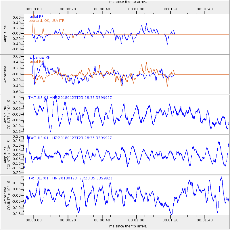
TUL3 Leonard, OK, USA - Earthquake Result Viewer
*The percent match for this event was below the threshold and hence no stack was calculated.
| Earthquake location: |
Gulf Of Alaska |
| Earthquake latitude/longitude: |
56.6/-148.1 |
| Earthquake time(UTC): |
2018/01/23 (023) 23:21:27 GMT |
| Earthquake Depth: |
12 km |
| Earthquake Magnitude: |
5.3 Mww |
| Earthquake Catalog/Contributor: |
NEIC PDE/ak |
|
| Network: |
TA USArray Transportable Network (new EarthScope stations) |
| Station: |
TUL3 Leonard, OK, USA |
| Lat/Lon: |
35.91 N/95.79 W |
| Elevation: |
265 m |
|
| Distance: |
40.5 deg |
| Az: |
97.965 deg |
| Baz: |
317.543 deg |
| Ray Param: |
$rayparam |
*The percent match for this event was below the threshold and hence was not used in the summary stack. |
|
| Radial Match: |
50.671284 % |
| Radial Bump: |
400 |
| Transverse Match: |
49.165302 % |
| Transverse Bump: |
400 |
| SOD ConfigId: |
2546091 |
| Insert Time: |
2018-02-06 23:23:53.345 +0000 |
| GWidth: |
2.5 |
| Max Bumps: |
400 |
| Tol: |
0.001 |
|
Signal To Noise
| Channel | StoN | STA | LTA |
| TA:TUL3:01:HHZ:20180123T23:28:35.339992Z | 0.6101597 | 3.6349252E-8 | 5.9573345E-8 |
| TA:TUL3:01:HHN:20180123T23:28:35.339992Z | 0.8850039 | 5.2039187E-8 | 5.8801078E-8 |
| TA:TUL3:01:HHE:20180123T23:28:35.339992Z | 0.9751084 | 7.1221194E-8 | 7.303926E-8 |
| Arrivals |
| Ps | |
| PpPs | |
| PsPs/PpSs | |


