You are here: Home > Network List > US - United States National Seismic Network Stations List
> Station ERPA Erie, Pennsylvania, USA > Earthquake Result Viewer
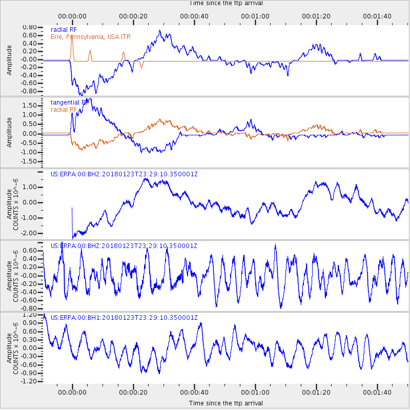
ERPA Erie, Pennsylvania, USA - Earthquake Result Viewer
*The percent match for this event was below the threshold and hence no stack was calculated.
| Earthquake location: |
Gulf Of Alaska |
| Earthquake latitude/longitude: |
56.6/-148.1 |
| Earthquake time(UTC): |
2018/01/23 (023) 23:21:27 GMT |
| Earthquake Depth: |
12 km |
| Earthquake Magnitude: |
5.3 Mww |
| Earthquake Catalog/Contributor: |
NEIC PDE/ak |
|
| Network: |
US United States National Seismic Network |
| Station: |
ERPA Erie, Pennsylvania, USA |
| Lat/Lon: |
42.12 N/79.99 W |
| Elevation: |
306 m |
|
| Distance: |
44.8 deg |
| Az: |
78.611 deg |
| Baz: |
313.191 deg |
| Ray Param: |
$rayparam |
*The percent match for this event was below the threshold and hence was not used in the summary stack. |
|
| Radial Match: |
55.506706 % |
| Radial Bump: |
400 |
| Transverse Match: |
57.917625 % |
| Transverse Bump: |
400 |
| SOD ConfigId: |
2546091 |
| Insert Time: |
2018-02-06 23:24:23.586 +0000 |
| GWidth: |
2.5 |
| Max Bumps: |
400 |
| Tol: |
0.001 |
|
Signal To Noise
| Channel | StoN | STA | LTA |
| US:ERPA:00:BHZ:20180123T23:29:10.350001Z | 0.88469464 | 2.881719E-7 | 3.2573035E-7 |
| US:ERPA:00:BH1:20180123T23:29:10.350001Z | 0.6977448 | 4.6035134E-7 | 6.597704E-7 |
| US:ERPA:00:BH2:20180123T23:29:10.350001Z | 1.5967996 | 1.7067658E-6 | 1.0688666E-6 |
| Arrivals |
| Ps | |
| PpPs | |
| PsPs/PpSs | |


