You are here: Home > Network List > G - GEOSCOPE Stations List
> Station PPTF Pamatai - Papeete - Tahiti island - French Polynesia, France > Earthquake Result Viewer
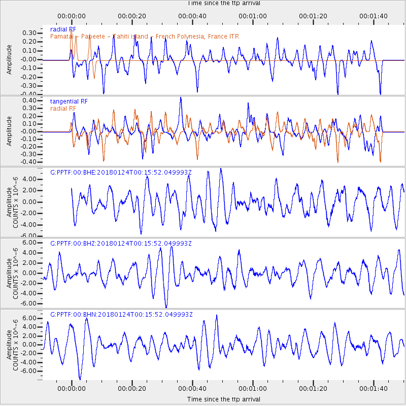
PPTF Pamatai - Papeete - Tahiti island - French Polynesia, France - Earthquake Result Viewer
*The percent match for this event was below the threshold and hence no stack was calculated.
| Earthquake location: |
Gulf Of Alaska |
| Earthquake latitude/longitude: |
56.5/-148.5 |
| Earthquake time(UTC): |
2018/01/24 (024) 00:04:48 GMT |
| Earthquake Depth: |
10 km |
| Earthquake Magnitude: |
5.5 Mww |
| Earthquake Catalog/Contributor: |
NEIC PDE/us |
|
| Network: |
G GEOSCOPE |
| Station: |
PPTF Pamatai - Papeete - Tahiti island - French Polynesia, France |
| Lat/Lon: |
17.59 S/149.57 W |
| Elevation: |
705 m |
|
| Distance: |
73.8 deg |
| Az: |
181.044 deg |
| Baz: |
0.606 deg |
| Ray Param: |
$rayparam |
*The percent match for this event was below the threshold and hence was not used in the summary stack. |
|
| Radial Match: |
59.471348 % |
| Radial Bump: |
400 |
| Transverse Match: |
54.45839 % |
| Transverse Bump: |
400 |
| SOD ConfigId: |
2546091 |
| Insert Time: |
2018-02-07 00:07:16.857 +0000 |
| GWidth: |
2.5 |
| Max Bumps: |
400 |
| Tol: |
0.001 |
|
Signal To Noise
| Channel | StoN | STA | LTA |
| G:PPTF:00:BHZ:20180124T00:15:52.049993Z | 0.41987935 | 6.832687E-7 | 1.6272977E-6 |
| G:PPTF:00:BHN:20180124T00:15:52.049993Z | 2.0719035 | 4.420799E-6 | 2.1336896E-6 |
| G:PPTF:00:BHE:20180124T00:15:52.049993Z | 1.1372939 | 2.1208925E-6 | 1.8648586E-6 |
| Arrivals |
| Ps | |
| PpPs | |
| PsPs/PpSs | |


