You are here: Home > Network List > II - Global Seismograph Network (GSN - IRIS/IDA) Stations List
> Station PFO Pinon Flat, California, USA > Earthquake Result Viewer
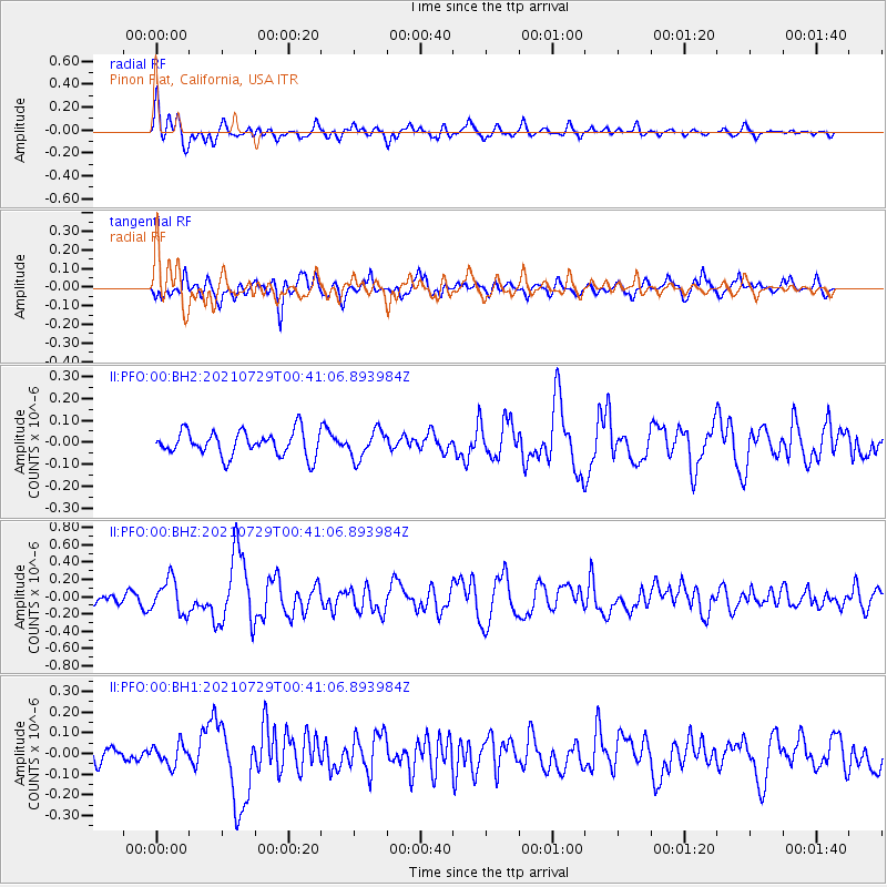
PFO Pinon Flat, California, USA - Earthquake Result Viewer
*The percent match for this event was below the threshold and hence no stack was calculated.
| Earthquake location: |
Near Coast Of Northern Peru |
| Earthquake latitude/longitude: |
-8.3/-80.0 |
| Earthquake time(UTC): |
2021/07/29 (210) 00:32:13 GMT |
| Earthquake Depth: |
23 km |
| Earthquake Magnitude: |
5.8 Mww |
| Earthquake Catalog/Contributor: |
NEIC PDE/us |
|
| Network: |
II Global Seismograph Network (GSN - IRIS/IDA) |
| Station: |
PFO Pinon Flat, California, USA |
| Lat/Lon: |
33.61 N/116.46 W |
| Elevation: |
1280 m |
|
| Distance: |
54.2 deg |
| Az: |
322.291 deg |
| Baz: |
133.508 deg |
| Ray Param: |
$rayparam |
*The percent match for this event was below the threshold and hence was not used in the summary stack. |
|
| Radial Match: |
73.70543 % |
| Radial Bump: |
400 |
| Transverse Match: |
60.894768 % |
| Transverse Bump: |
400 |
| SOD ConfigId: |
25131211 |
| Insert Time: |
2021-08-12 00:47:05.237 +0000 |
| GWidth: |
2.5 |
| Max Bumps: |
400 |
| Tol: |
0.001 |
|
Signal To Noise
| Channel | StoN | STA | LTA |
| II:PFO:00:BHZ:20210729T00:41:06.893984Z | 2.3215525 | 1.959309E-7 | 8.43965E-8 |
| II:PFO:00:BH1:20210729T00:41:06.893984Z | 0.9722535 | 5.0228685E-8 | 5.1662127E-8 |
| II:PFO:00:BH2:20210729T00:41:06.893984Z | 1.1464832 | 6.368561E-8 | 5.5548664E-8 |
| Arrivals |
| Ps | |
| PpPs | |
| PsPs/PpSs | |


