You are here: Home > Network List > IU - Global Seismograph Network (GSN - IRIS/USGS) Stations List
> Station RSSD Black Hills, South Dakota, USA > Earthquake Result Viewer
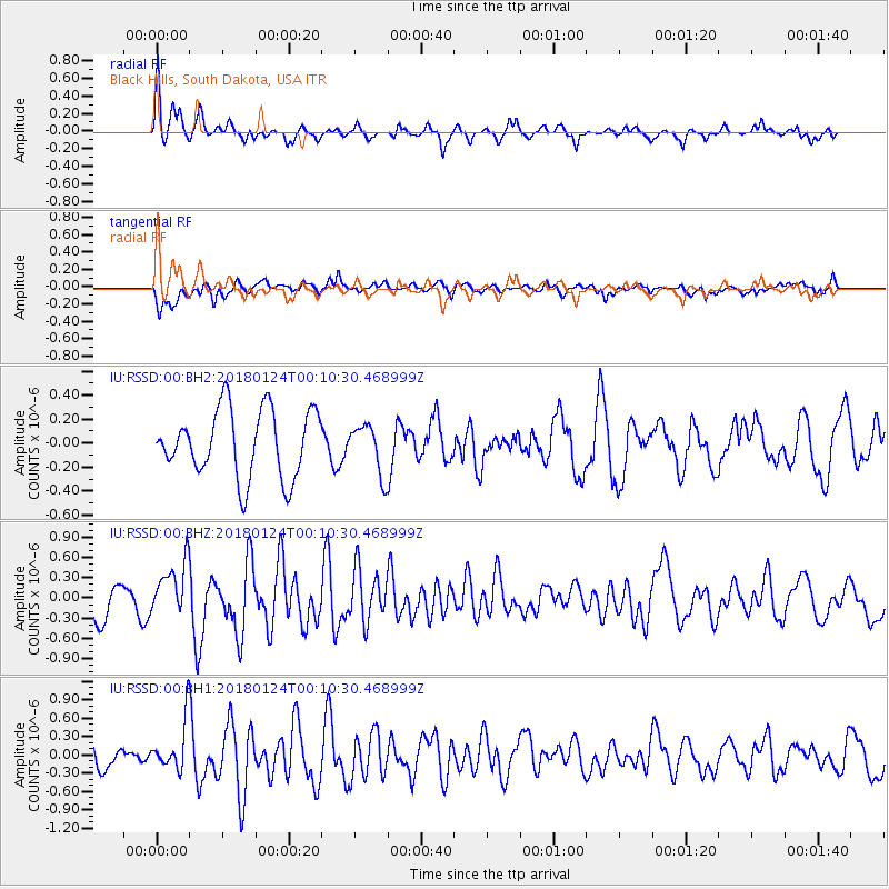
RSSD Black Hills, South Dakota, USA - Earthquake Result Viewer
*The percent match for this event was below the threshold and hence no stack was calculated.
| Earthquake location: |
Gulf Of Alaska |
| Earthquake latitude/longitude: |
56.5/-148.5 |
| Earthquake time(UTC): |
2018/01/24 (024) 00:04:48 GMT |
| Earthquake Depth: |
10 km |
| Earthquake Magnitude: |
5.5 Mww |
| Earthquake Catalog/Contributor: |
NEIC PDE/us |
|
| Network: |
IU Global Seismograph Network (GSN - IRIS/USGS) |
| Station: |
RSSD Black Hills, South Dakota, USA |
| Lat/Lon: |
44.12 N/104.04 W |
| Elevation: |
2090 m |
|
| Distance: |
30.4 deg |
| Az: |
94.92 deg |
| Baz: |
309.965 deg |
| Ray Param: |
$rayparam |
*The percent match for this event was below the threshold and hence was not used in the summary stack. |
|
| Radial Match: |
63.818367 % |
| Radial Bump: |
400 |
| Transverse Match: |
56.498272 % |
| Transverse Bump: |
400 |
| SOD ConfigId: |
2546091 |
| Insert Time: |
2018-02-07 00:08:20.852 +0000 |
| GWidth: |
2.5 |
| Max Bumps: |
400 |
| Tol: |
0.001 |
|
Signal To Noise
| Channel | StoN | STA | LTA |
| IU:RSSD:00:BHZ:20180124T00:10:30.468999Z | 1.7049056 | 3.919706E-7 | 2.2990751E-7 |
| IU:RSSD:00:BH1:20180124T00:10:30.468999Z | 2.2146206 | 4.1931582E-7 | 1.893398E-7 |
| IU:RSSD:00:BH2:20180124T00:10:30.468999Z | 0.7292579 | 2.0409136E-7 | 2.7986172E-7 |
| Arrivals |
| Ps | |
| PpPs | |
| PsPs/PpSs | |


