You are here: Home > Network List > US - United States National Seismic Network Stations List
> Station CBKS Cedar Bluff, Kansas, USA > Earthquake Result Viewer
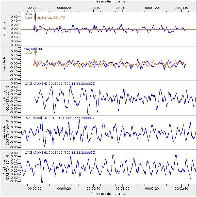
CBKS Cedar Bluff, Kansas, USA - Earthquake Result Viewer
*The percent match for this event was below the threshold and hence no stack was calculated.
| Earthquake location: |
Gulf Of Alaska |
| Earthquake latitude/longitude: |
56.5/-148.5 |
| Earthquake time(UTC): |
2018/01/24 (024) 00:04:48 GMT |
| Earthquake Depth: |
10 km |
| Earthquake Magnitude: |
5.5 Mww |
| Earthquake Catalog/Contributor: |
NEIC PDE/us |
|
| Network: |
US United States National Seismic Network |
| Station: |
CBKS Cedar Bluff, Kansas, USA |
| Lat/Lon: |
38.81 N/99.74 W |
| Elevation: |
677 m |
|
| Distance: |
36.4 deg |
| Az: |
98.016 deg |
| Baz: |
315.393 deg |
| Ray Param: |
$rayparam |
*The percent match for this event was below the threshold and hence was not used in the summary stack. |
|
| Radial Match: |
60.684776 % |
| Radial Bump: |
399 |
| Transverse Match: |
63.01917 % |
| Transverse Bump: |
381 |
| SOD ConfigId: |
2546091 |
| Insert Time: |
2018-02-07 00:09:58.710 +0000 |
| GWidth: |
2.5 |
| Max Bumps: |
400 |
| Tol: |
0.001 |
|
Signal To Noise
| Channel | StoN | STA | LTA |
| US:CBKS:00:BHZ:20180124T00:11:22.299993Z | 2.4987051 | 3.9115557E-7 | 1.5654331E-7 |
| US:CBKS:00:BH1:20180124T00:11:22.299993Z | 1.5780988 | 3.5132976E-7 | 2.2262851E-7 |
| US:CBKS:00:BH2:20180124T00:11:22.299993Z | 0.9756174 | 3.508071E-7 | 3.595745E-7 |
| Arrivals |
| Ps | |
| PpPs | |
| PsPs/PpSs | |


