You are here: Home > Network List > US - United States National Seismic Network Stations List
> Station HAWA Hanford, Washington, USA > Earthquake Result Viewer
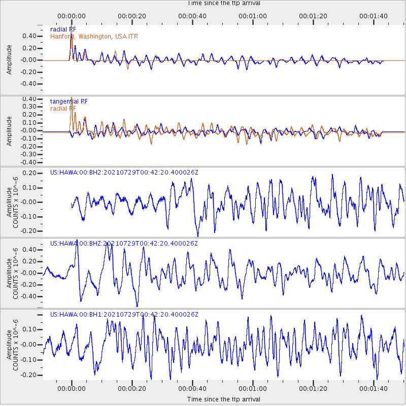
HAWA Hanford, Washington, USA - Earthquake Result Viewer
*The percent match for this event was below the threshold and hence no stack was calculated.
| Earthquake location: |
Near Coast Of Northern Peru |
| Earthquake latitude/longitude: |
-8.3/-80.0 |
| Earthquake time(UTC): |
2021/07/29 (210) 00:32:13 GMT |
| Earthquake Depth: |
23 km |
| Earthquake Magnitude: |
5.8 Mww |
| Earthquake Catalog/Contributor: |
NEIC PDE/us |
|
| Network: |
US United States National Seismic Network |
| Station: |
HAWA Hanford, Washington, USA |
| Lat/Lon: |
46.39 N/119.53 W |
| Elevation: |
364 m |
|
| Distance: |
64.9 deg |
| Az: |
330.87 deg |
| Baz: |
135.895 deg |
| Ray Param: |
$rayparam |
*The percent match for this event was below the threshold and hence was not used in the summary stack. |
|
| Radial Match: |
70.1346 % |
| Radial Bump: |
400 |
| Transverse Match: |
70.953766 % |
| Transverse Bump: |
400 |
| SOD ConfigId: |
25131211 |
| Insert Time: |
2021-08-12 01:00:01.372 +0000 |
| GWidth: |
2.5 |
| Max Bumps: |
400 |
| Tol: |
0.001 |
|
Signal To Noise
| Channel | StoN | STA | LTA |
| US:HAWA:00:BHZ:20210729T00:42:20.400026Z | 6.868391 | 2.9874724E-7 | 4.349596E-8 |
| US:HAWA:00:BH1:20210729T00:42:20.400026Z | 1.9520144 | 6.838423E-8 | 3.5032645E-8 |
| US:HAWA:00:BH2:20210729T00:42:20.400026Z | 2.0241883 | 8.48631E-8 | 4.192451E-8 |
| Arrivals |
| Ps | |
| PpPs | |
| PsPs/PpSs | |


