You are here: Home > Network List > UW - Pacific Northwest Regional Seismic Network Stations List
> Station BLOW Detroit Lake, OR, USA > Earthquake Result Viewer
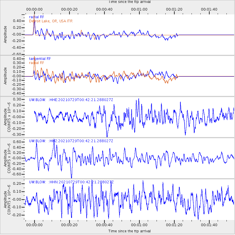
BLOW Detroit Lake, OR, USA - Earthquake Result Viewer
*The percent match for this event was below the threshold and hence no stack was calculated.
| Earthquake location: |
Near Coast Of Northern Peru |
| Earthquake latitude/longitude: |
-8.3/-80.0 |
| Earthquake time(UTC): |
2021/07/29 (210) 00:32:13 GMT |
| Earthquake Depth: |
23 km |
| Earthquake Magnitude: |
5.8 Mww |
| Earthquake Catalog/Contributor: |
NEIC PDE/us |
|
| Network: |
UW Pacific Northwest Regional Seismic Network |
| Station: |
BLOW Detroit Lake, OR, USA |
| Lat/Lon: |
44.68 N/122.19 W |
| Elevation: |
652 m |
|
| Distance: |
65.1 deg |
| Az: |
328.083 deg |
| Baz: |
132.828 deg |
| Ray Param: |
$rayparam |
*The percent match for this event was below the threshold and hence was not used in the summary stack. |
|
| Radial Match: |
59.549572 % |
| Radial Bump: |
400 |
| Transverse Match: |
56.922764 % |
| Transverse Bump: |
400 |
| SOD ConfigId: |
25131211 |
| Insert Time: |
2021-08-12 01:01:39.396 +0000 |
| GWidth: |
2.5 |
| Max Bumps: |
400 |
| Tol: |
0.001 |
|
Signal To Noise
| Channel | StoN | STA | LTA |
| UW:BLOW: :HHZ:20210729T00:42:21.288027Z | 3.8674054 | 2.1978583E-7 | 5.683031E-8 |
| UW:BLOW: :HHN:20210729T00:42:21.288027Z | 1.1831173 | 6.798002E-8 | 5.7458394E-8 |
| UW:BLOW: :HHE:20210729T00:42:21.288027Z | 1.5382636 | 8.163848E-8 | 5.307184E-8 |
| Arrivals |
| Ps | |
| PpPs | |
| PsPs/PpSs | |


