You are here: Home > Network List > WY - Yellowstone Wyoming Seismic Network Stations List
> Station YNR Norris Junction, YNP, WY, USA > Earthquake Result Viewer
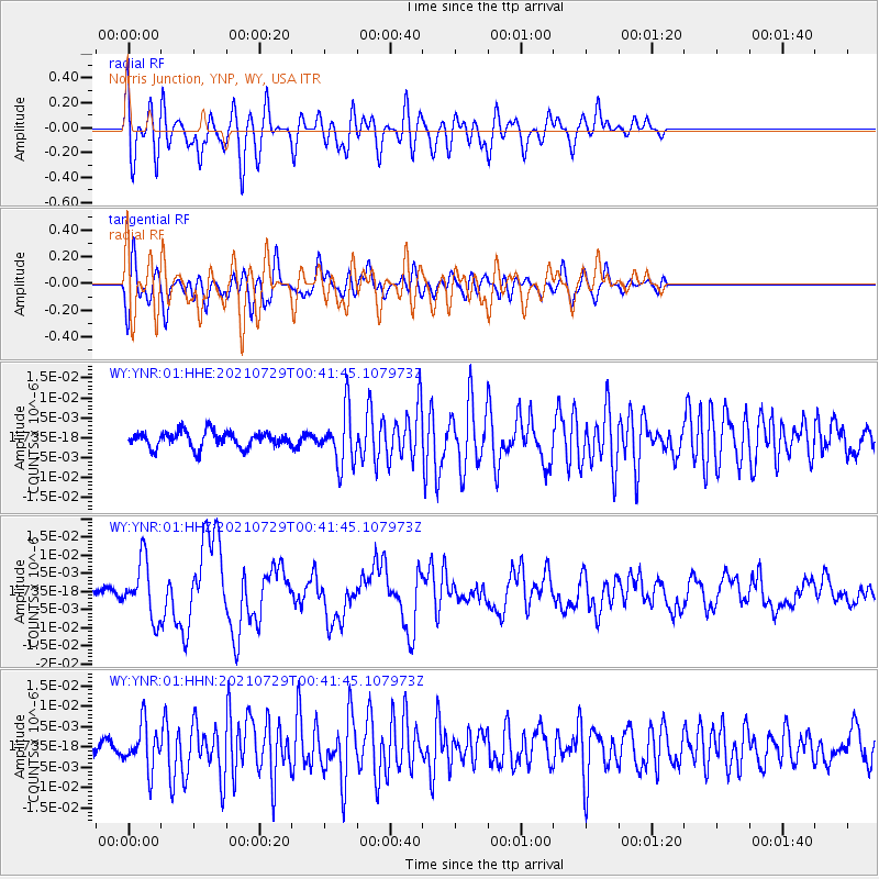
YNR Norris Junction, YNP, WY, USA - Earthquake Result Viewer
*The percent match for this event was below the threshold and hence no stack was calculated.
| Earthquake location: |
Near Coast Of Northern Peru |
| Earthquake latitude/longitude: |
-8.3/-80.0 |
| Earthquake time(UTC): |
2021/07/29 (210) 00:32:13 GMT |
| Earthquake Depth: |
23 km |
| Earthquake Magnitude: |
5.8 Mww |
| Earthquake Catalog/Contributor: |
NEIC PDE/us |
|
| Network: |
WY Yellowstone Wyoming Seismic Network |
| Station: |
YNR Norris Junction, YNP, WY, USA |
| Lat/Lon: |
44.72 N/110.68 W |
| Elevation: |
2336 m |
|
| Distance: |
59.6 deg |
| Az: |
335.037 deg |
| Baz: |
144.143 deg |
| Ray Param: |
$rayparam |
*The percent match for this event was below the threshold and hence was not used in the summary stack. |
|
| Radial Match: |
53.776455 % |
| Radial Bump: |
400 |
| Transverse Match: |
70.80937 % |
| Transverse Bump: |
400 |
| SOD ConfigId: |
25131211 |
| Insert Time: |
2021-08-12 01:04:19.983 +0000 |
| GWidth: |
2.5 |
| Max Bumps: |
400 |
| Tol: |
0.001 |
|
Signal To Noise
| Channel | StoN | STA | LTA |
| WY:YNR:01:HHZ:20210729T00:41:45.107973Z | 6.33551 | 7.697597E-9 | 1.2149926E-9 |
| WY:YNR:01:HHN:20210729T00:41:45.107973Z | 3.8181875 | 5.4465317E-9 | 1.4264705E-9 |
| WY:YNR:01:HHE:20210729T00:41:45.107973Z | 3.3755603 | 6.69093E-9 | 1.9821687E-9 |
| Arrivals |
| Ps | |
| PpPs | |
| PsPs/PpSs | |


