You are here: Home > Network List > G - GEOSCOPE Stations List
> Station KIP Kipapa, Hawai, U.S.A. (Pacific Ocean) > Earthquake Result Viewer
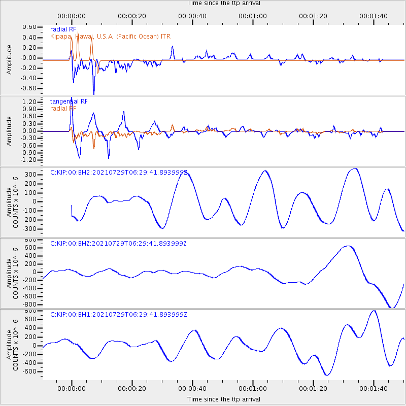
KIP Kipapa, Hawai, U.S.A. (Pacific Ocean) - Earthquake Result Viewer
*The percent match for this event was below the threshold and hence no stack was calculated.
| Earthquake location: |
Alaska Peninsula |
| Earthquake latitude/longitude: |
55.4/-157.3 |
| Earthquake time(UTC): |
2021/07/29 (210) 06:23:28 GMT |
| Earthquake Depth: |
5.3 km |
| Earthquake Magnitude: |
5.9 ml |
| Earthquake Catalog/Contributor: |
NEIC PDE/ak |
|
| Network: |
G GEOSCOPE |
| Station: |
KIP Kipapa, Hawai, U.S.A. (Pacific Ocean) |
| Lat/Lon: |
21.42 N/158.01 W |
| Elevation: |
70 m |
|
| Distance: |
33.9 deg |
| Az: |
181.128 deg |
| Baz: |
0.69 deg |
| Ray Param: |
$rayparam |
*The percent match for this event was below the threshold and hence was not used in the summary stack. |
|
| Radial Match: |
84.522766 % |
| Radial Bump: |
384 |
| Transverse Match: |
65.71994 % |
| Transverse Bump: |
400 |
| SOD ConfigId: |
25131211 |
| Insert Time: |
2021-08-12 06:59:59.087 +0000 |
| GWidth: |
2.5 |
| Max Bumps: |
400 |
| Tol: |
0.001 |
|
Signal To Noise
| Channel | StoN | STA | LTA |
| G:KIP:00:BHZ:20210729T06:29:41.893999Z | 0.7231529 | 5.869788E-5 | 8.116939E-5 |
| G:KIP:00:BH1:20210729T06:29:41.893999Z | 1.4273382 | 9.681862E-5 | 6.783159E-5 |
| G:KIP:00:BH2:20210729T06:29:41.893999Z | 2.2919903 | 1.9486727E-4 | 8.502099E-5 |
| Arrivals |
| Ps | |
| PpPs | |
| PsPs/PpSs | |


