You are here: Home > Network List > NM - Cooperative New Madrid Seismic Network Stations List
> Station UTMT Martin, TN > Earthquake Result Viewer
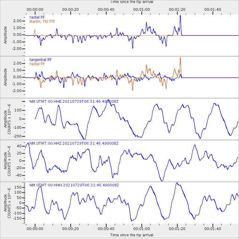
UTMT Martin, TN - Earthquake Result Viewer
*The percent match for this event was below the threshold and hence no stack was calculated.
| Earthquake location: |
Alaska Peninsula |
| Earthquake latitude/longitude: |
55.4/-157.3 |
| Earthquake time(UTC): |
2021/07/29 (210) 06:23:28 GMT |
| Earthquake Depth: |
5.3 km |
| Earthquake Magnitude: |
5.9 ml |
| Earthquake Catalog/Contributor: |
NEIC PDE/ak |
|
| Network: |
NM Cooperative New Madrid Seismic Network |
| Station: |
UTMT Martin, TN |
| Lat/Lon: |
36.35 N/88.86 W |
| Elevation: |
110 m |
|
| Distance: |
49.2 deg |
| Az: |
82.922 deg |
| Baz: |
315.488 deg |
| Ray Param: |
$rayparam |
*The percent match for this event was below the threshold and hence was not used in the summary stack. |
|
| Radial Match: |
65.52387 % |
| Radial Bump: |
398 |
| Transverse Match: |
58.261208 % |
| Transverse Bump: |
373 |
| SOD ConfigId: |
25131211 |
| Insert Time: |
2021-08-12 07:05:52.110 +0000 |
| GWidth: |
2.5 |
| Max Bumps: |
400 |
| Tol: |
0.001 |
|
Signal To Noise
| Channel | StoN | STA | LTA |
| NM:UTMT:00:HHZ:20210729T06:31:46.490008Z | 0.6908477 | 1.7353494E-5 | 2.511913E-5 |
| NM:UTMT:00:HHN:20210729T06:31:46.490008Z | 3.216857 | 1.04801875E-4 | 3.2578966E-5 |
| NM:UTMT:00:HHE:20210729T06:31:46.490008Z | 1.4306747 | 1.0300766E-4 | 7.199936E-5 |
| Arrivals |
| Ps | |
| PpPs | |
| PsPs/PpSs | |


