You are here: Home > Network List > CI - Caltech Regional Seismic Network Stations List
> Station MPM Manuel Prospect Mine, California, USA > Earthquake Result Viewer
MPM Manuel Prospect Mine, California, USA - Earthquake Result Viewer
*The percent match for this event was below the threshold and hence no stack was calculated.
| Earthquake location: |
South Of Alaska |
| Earthquake latitude/longitude: |
54.9/-156.4 |
| Earthquake time(UTC): |
2021/07/29 (210) 06:32:30 GMT |
| Earthquake Depth: |
10 km |
| Earthquake Magnitude: |
5.8 mb |
| Earthquake Catalog/Contributor: |
NEIC PDE/ak |
|
| Network: |
CI Caltech Regional Seismic Network |
| Station: |
MPM Manuel Prospect Mine, California, USA |
| Lat/Lon: |
36.06 N/117.49 W |
| Elevation: |
185 m |
|
| Distance: |
32.6 deg |
| Az: |
109.116 deg |
| Baz: |
317.689 deg |
| Ray Param: |
$rayparam |
*The percent match for this event was below the threshold and hence was not used in the summary stack. |
|
| Radial Match: |
87.04687 % |
| Radial Bump: |
400 |
| Transverse Match: |
86.603 % |
| Transverse Bump: |
400 |
| SOD ConfigId: |
25131211 |
| Insert Time: |
2021-08-12 07:31:42.111 +0000 |
| GWidth: |
2.5 |
| Max Bumps: |
400 |
| Tol: |
0.001 |
|
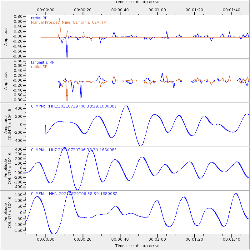
Signal To Noise
| Channel | StoN | STA | LTA |
| CI:MPM: :HHZ:20210729T06:38:39.168008Z | 4.229791 | 2.5792743E-4 | 6.0978764E-5 |
| CI:MPM: :HHN:20210729T06:38:39.168008Z | 1.914524 | 1.2562203E-4 | 6.561528E-5 |
| CI:MPM: :HHE:20210729T06:38:39.168008Z | 1.5722209 | 1.4423442E-4 | 9.173928E-5 |
| Arrivals |
| Ps | |
| PpPs | |
| PsPs/PpSs | |


