You are here: Home > Network List > GS - US Geological Survey Networks Stations List
> Station DEC09 Kile Street Surface Site > Earthquake Result Viewer
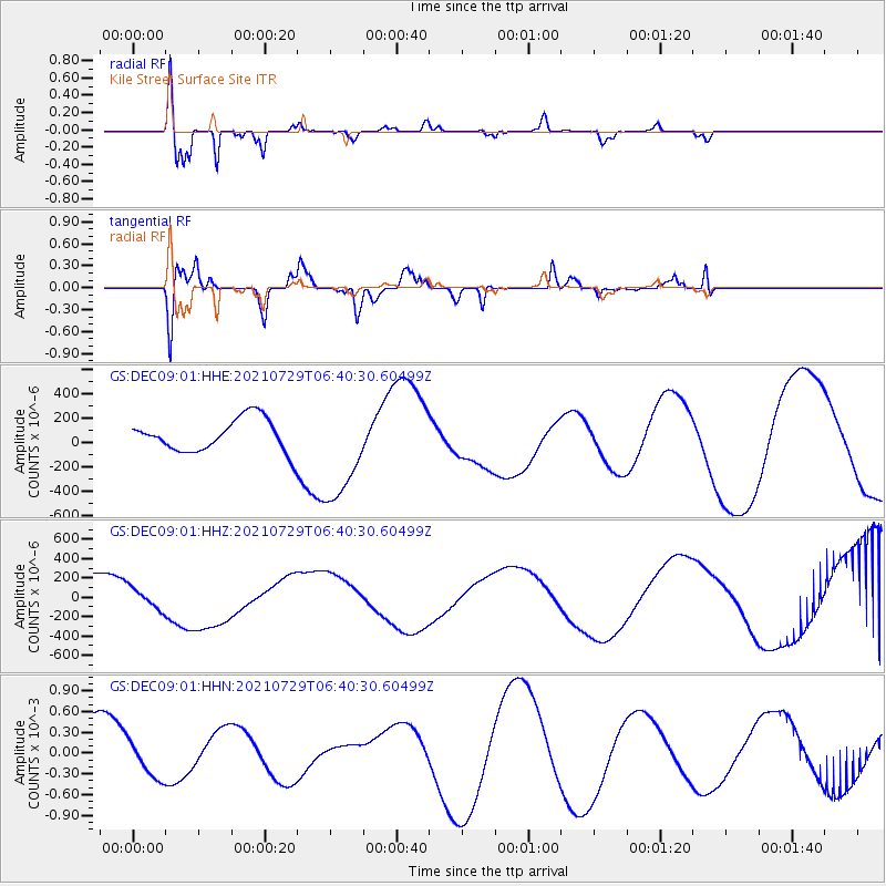
DEC09 Kile Street Surface Site - Earthquake Result Viewer
*The percent match for this event was below the threshold and hence no stack was calculated.
| Earthquake location: |
South Of Alaska |
| Earthquake latitude/longitude: |
54.9/-156.4 |
| Earthquake time(UTC): |
2021/07/29 (210) 06:32:30 GMT |
| Earthquake Depth: |
10 km |
| Earthquake Magnitude: |
5.8 mb |
| Earthquake Catalog/Contributor: |
NEIC PDE/ak |
|
| Network: |
GS US Geological Survey Networks |
| Station: |
DEC09 Kile Street Surface Site |
| Lat/Lon: |
39.87 N/88.92 W |
| Elevation: |
207 m |
|
| Distance: |
46.2 deg |
| Az: |
79.79 deg |
| Baz: |
312.416 deg |
| Ray Param: |
$rayparam |
*The percent match for this event was below the threshold and hence was not used in the summary stack. |
|
| Radial Match: |
60.948948 % |
| Radial Bump: |
272 |
| Transverse Match: |
31.459131 % |
| Transverse Bump: |
307 |
| SOD ConfigId: |
25131211 |
| Insert Time: |
2021-08-12 07:33:50.170 +0000 |
| GWidth: |
2.5 |
| Max Bumps: |
400 |
| Tol: |
0.001 |
|
Signal To Noise
| Channel | StoN | STA | LTA |
| GS:DEC09:01:HHZ:20210729T06:40:30.60499Z | 0.52509505 | 1.0588805E-4 | 2.0165503E-4 |
| GS:DEC09:01:HHN:20210729T06:40:30.60499Z | 0.60305214 | 2.576853E-4 | 4.2730183E-4 |
| GS:DEC09:01:HHE:20210729T06:40:30.60499Z | 3.504748 | 4.1781872E-4 | 1.19215045E-4 |
| Arrivals |
| Ps | |
| PpPs | |
| PsPs/PpSs | |


