You are here: Home > Network List > TX - Texas Seismological Network Stations List
> Station WTFS Witchita Falls > Earthquake Result Viewer
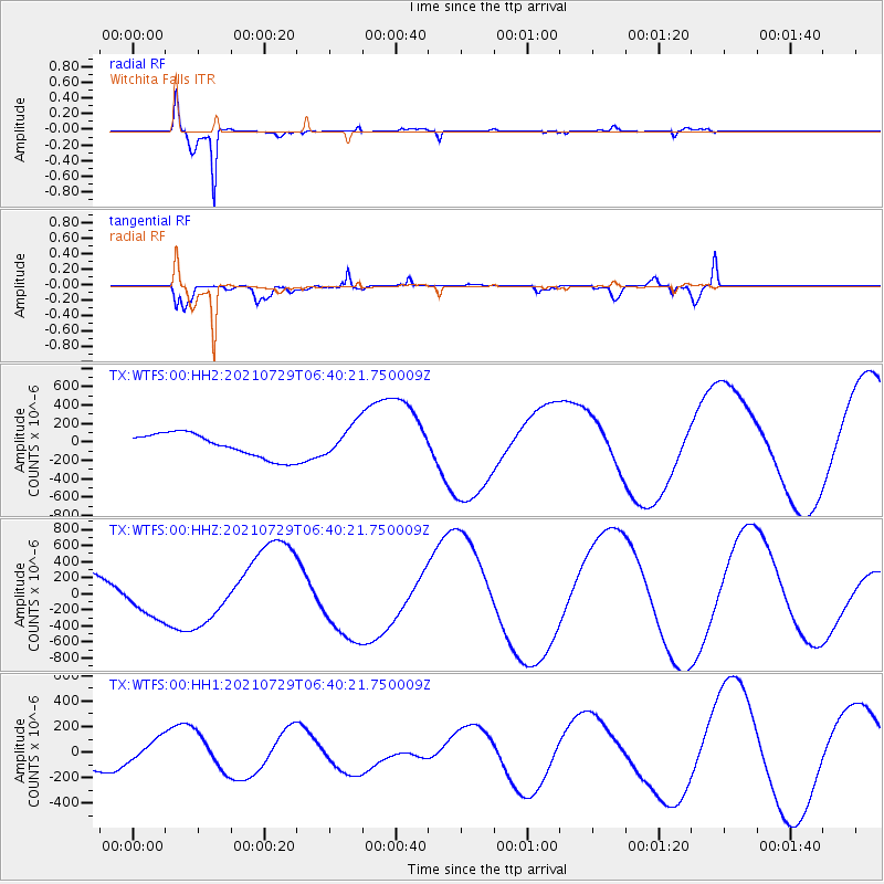
WTFS Witchita Falls - Earthquake Result Viewer
*The percent match for this event was below the threshold and hence no stack was calculated.
| Earthquake location: |
South Of Alaska |
| Earthquake latitude/longitude: |
54.9/-156.4 |
| Earthquake time(UTC): |
2021/07/29 (210) 06:32:30 GMT |
| Earthquake Depth: |
10 km |
| Earthquake Magnitude: |
5.8 mb |
| Earthquake Catalog/Contributor: |
NEIC PDE/ak |
|
| Network: |
TX Texas Seismological Network |
| Station: |
WTFS Witchita Falls |
| Lat/Lon: |
33.77 N/98.46 W |
| Elevation: |
277 m |
|
| Distance: |
45.0 deg |
| Az: |
93.373 deg |
| Baz: |
316.228 deg |
| Ray Param: |
$rayparam |
*The percent match for this event was below the threshold and hence was not used in the summary stack. |
|
| Radial Match: |
97.878746 % |
| Radial Bump: |
242 |
| Transverse Match: |
79.42611 % |
| Transverse Bump: |
400 |
| SOD ConfigId: |
25131211 |
| Insert Time: |
2021-08-12 07:40:49.189 +0000 |
| GWidth: |
2.5 |
| Max Bumps: |
400 |
| Tol: |
0.001 |
|
Signal To Noise
| Channel | StoN | STA | LTA |
| TX:WTFS:00:HHZ:20210729T06:40:21.750009Z | 1.1321608 | 2.7457176E-4 | 2.4252012E-4 |
| TX:WTFS:00:HH1:20210729T06:40:21.750009Z | 1.7562876 | 1.0210342E-4 | 5.8135935E-5 |
| TX:WTFS:00:HH2:20210729T06:40:21.750009Z | 3.0652442 | 2.5377137E-4 | 8.2789935E-5 |
| Arrivals |
| Ps | |
| PpPs | |
| PsPs/PpSs | |


