You are here: Home > Network List > US - United States National Seismic Network Stations List
> Station MSO Missoula, Montana, USA > Earthquake Result Viewer
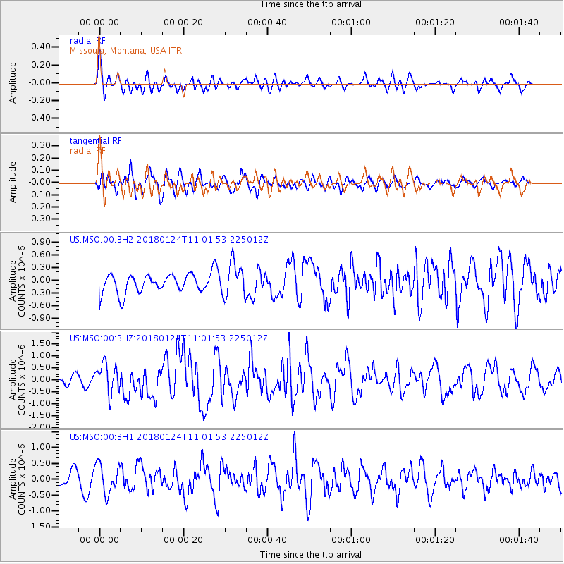
MSO Missoula, Montana, USA - Earthquake Result Viewer
*The percent match for this event was below the threshold and hence no stack was calculated.
| Earthquake location: |
Hokkaido, Japan Region |
| Earthquake latitude/longitude: |
41.1/142.3 |
| Earthquake time(UTC): |
2018/01/24 (024) 10:51:20 GMT |
| Earthquake Depth: |
40 km |
| Earthquake Magnitude: |
6.2 Mww |
| Earthquake Catalog/Contributor: |
NEIC PDE/us |
|
| Network: |
US United States National Seismic Network |
| Station: |
MSO Missoula, Montana, USA |
| Lat/Lon: |
46.83 N/113.94 W |
| Elevation: |
1264 m |
|
| Distance: |
69.3 deg |
| Az: |
45.459 deg |
| Baz: |
308.349 deg |
| Ray Param: |
$rayparam |
*The percent match for this event was below the threshold and hence was not used in the summary stack. |
|
| Radial Match: |
56.397835 % |
| Radial Bump: |
400 |
| Transverse Match: |
69.7286 % |
| Transverse Bump: |
400 |
| SOD ConfigId: |
2546091 |
| Insert Time: |
2018-02-07 10:57:56.417 +0000 |
| GWidth: |
2.5 |
| Max Bumps: |
400 |
| Tol: |
0.001 |
|
Signal To Noise
| Channel | StoN | STA | LTA |
| US:MSO:00:BHZ:20180124T11:01:53.225012Z | 2.6317089 | 6.204541E-7 | 2.3576092E-7 |
| US:MSO:00:BH1:20180124T11:01:53.225012Z | 1.912828 | 4.6011823E-7 | 2.4054344E-7 |
| US:MSO:00:BH2:20180124T11:01:53.225012Z | 1.9432117 | 4.0528326E-7 | 2.0856362E-7 |
| Arrivals |
| Ps | |
| PpPs | |
| PsPs/PpSs | |


