You are here: Home > Network List > AV - Alaska Volcano Observatory Stations List
> Station PLBL Mt. Peulik Volcano, Alaska > Earthquake Result Viewer
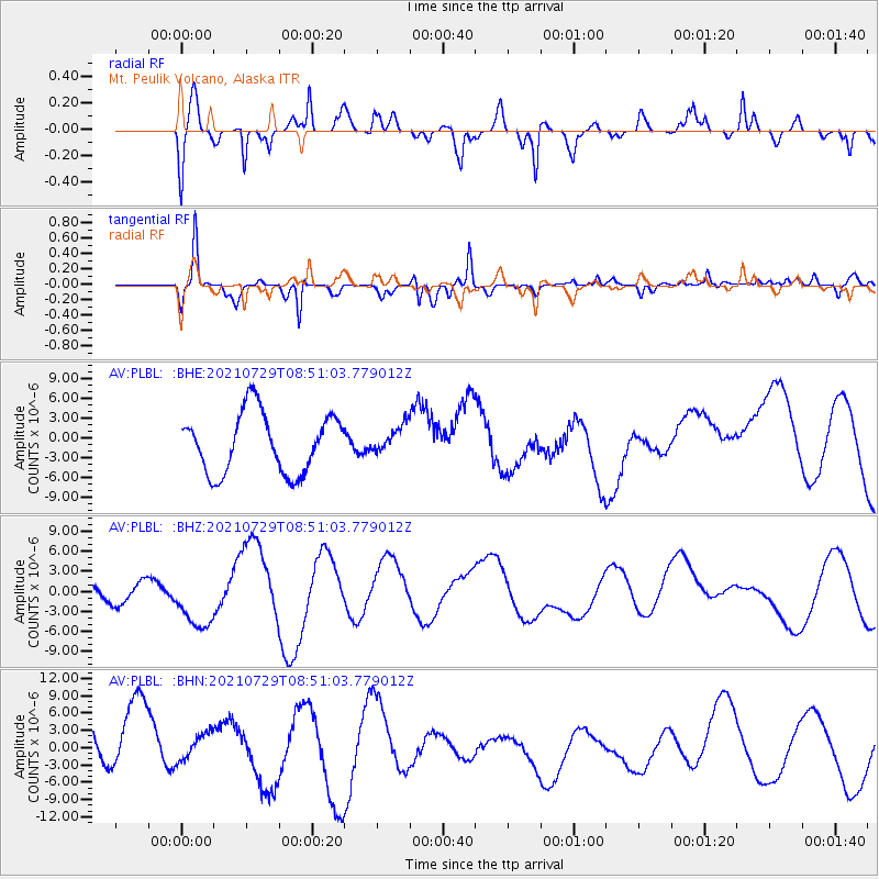
PLBL Mt. Peulik Volcano, Alaska - Earthquake Result Viewer
*The percent match for this event was below the threshold and hence no stack was calculated.
| Earthquake location: |
Myanmar |
| Earthquake latitude/longitude: |
22.9/96.0 |
| Earthquake time(UTC): |
2021/07/29 (210) 08:39:27 GMT |
| Earthquake Depth: |
10 km |
| Earthquake Magnitude: |
5.5 mb |
| Earthquake Catalog/Contributor: |
NEIC PDE/us |
|
| Network: |
AV Alaska Volcano Observatory |
| Station: |
PLBL Mt. Peulik Volcano, Alaska |
| Lat/Lon: |
57.70 N/156.82 W |
| Elevation: |
461 m |
|
| Distance: |
79.6 deg |
| Az: |
31.433 deg |
| Baz: |
296.388 deg |
| Ray Param: |
$rayparam |
*The percent match for this event was below the threshold and hence was not used in the summary stack. |
|
| Radial Match: |
54.779766 % |
| Radial Bump: |
400 |
| Transverse Match: |
70.12294 % |
| Transverse Bump: |
400 |
| SOD ConfigId: |
25131211 |
| Insert Time: |
2021-08-12 08:43:17.837 +0000 |
| GWidth: |
2.5 |
| Max Bumps: |
400 |
| Tol: |
0.001 |
|
Signal To Noise
| Channel | StoN | STA | LTA |
| AV:PLBL: :BHZ:20210729T08:51:03.779012Z | 1.8362559 | 5.127822E-6 | 2.7925423E-6 |
| AV:PLBL: :BHN:20210729T08:51:03.779012Z | 0.49272183 | 3.16355E-6 | 6.42056E-6 |
| AV:PLBL: :BHE:20210729T08:51:03.779012Z | 0.48494744 | 2.1636101E-6 | 4.4615354E-6 |
| Arrivals |
| Ps | |
| PpPs | |
| PsPs/PpSs | |


