You are here: Home > Network List > CI - Caltech Regional Seismic Network Stations List
> Station BAR Barrett, Tecate, CA, USA > Earthquake Result Viewer
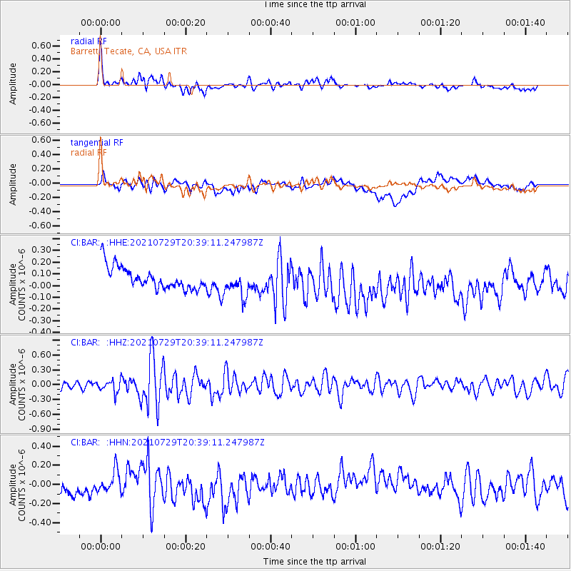
BAR Barrett, Tecate, CA, USA - Earthquake Result Viewer
*The percent match for this event was below the threshold and hence no stack was calculated.
| Earthquake location: |
South Of Alaska |
| Earthquake latitude/longitude: |
55.3/-156.9 |
| Earthquake time(UTC): |
2021/07/29 (210) 20:32:44 GMT |
| Earthquake Depth: |
45 km |
| Earthquake Magnitude: |
5.5 ml |
| Earthquake Catalog/Contributor: |
NEIC PDE/ak |
|
| Network: |
CI Caltech Regional Seismic Network |
| Station: |
BAR Barrett, Tecate, CA, USA |
| Lat/Lon: |
32.68 N/116.67 W |
| Elevation: |
521 m |
|
| Distance: |
36.0 deg |
| Az: |
112.053 deg |
| Baz: |
321.042 deg |
| Ray Param: |
$rayparam |
*The percent match for this event was below the threshold and hence was not used in the summary stack. |
|
| Radial Match: |
66.41526 % |
| Radial Bump: |
400 |
| Transverse Match: |
45.99772 % |
| Transverse Bump: |
400 |
| SOD ConfigId: |
25131211 |
| Insert Time: |
2021-08-12 20:35:49.720 +0000 |
| GWidth: |
2.5 |
| Max Bumps: |
400 |
| Tol: |
0.001 |
|
Signal To Noise
| Channel | StoN | STA | LTA |
| CI:BAR: :HHZ:20210729T20:39:11.247987Z | 1.6496086 | 1.2996065E-7 | 7.878272E-8 |
| CI:BAR: :HHN:20210729T20:39:11.247987Z | 1.1997026 | 1.12243484E-7 | 9.3559414E-8 |
| CI:BAR: :HHE:20210729T20:39:11.247987Z | 1.2198529 | 1.147885E-7 | 9.410028E-8 |
| Arrivals |
| Ps | |
| PpPs | |
| PsPs/PpSs | |


