You are here: Home > Network List > CI - Caltech Regional Seismic Network Stations List
> Station MPM Manuel Prospect Mine, California, USA > Earthquake Result Viewer
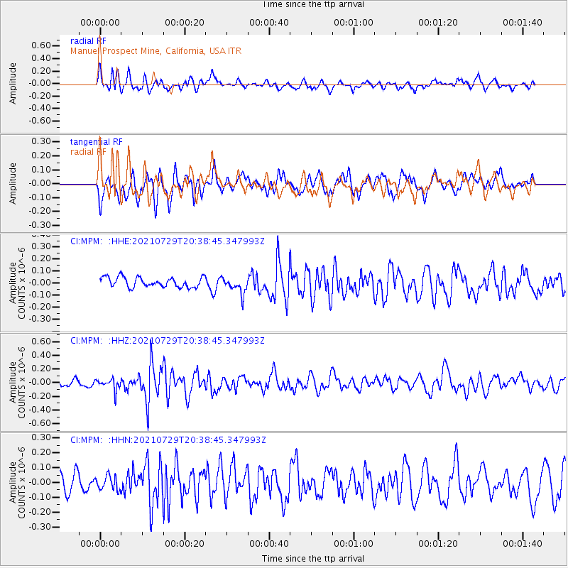
MPM Manuel Prospect Mine, California, USA - Earthquake Result Viewer
*The percent match for this event was below the threshold and hence no stack was calculated.
| Earthquake location: |
South Of Alaska |
| Earthquake latitude/longitude: |
55.3/-156.9 |
| Earthquake time(UTC): |
2021/07/29 (210) 20:32:44 GMT |
| Earthquake Depth: |
45 km |
| Earthquake Magnitude: |
5.5 ml |
| Earthquake Catalog/Contributor: |
NEIC PDE/ak |
|
| Network: |
CI Caltech Regional Seismic Network |
| Station: |
MPM Manuel Prospect Mine, California, USA |
| Lat/Lon: |
36.06 N/117.49 W |
| Elevation: |
185 m |
|
| Distance: |
33.0 deg |
| Az: |
109.105 deg |
| Baz: |
318.152 deg |
| Ray Param: |
$rayparam |
*The percent match for this event was below the threshold and hence was not used in the summary stack. |
|
| Radial Match: |
59.112164 % |
| Radial Bump: |
400 |
| Transverse Match: |
66.52499 % |
| Transverse Bump: |
400 |
| SOD ConfigId: |
25131211 |
| Insert Time: |
2021-08-12 20:36:24.471 +0000 |
| GWidth: |
2.5 |
| Max Bumps: |
400 |
| Tol: |
0.001 |
|
Signal To Noise
| Channel | StoN | STA | LTA |
| CI:MPM: :HHZ:20210729T20:38:45.347993Z | 1.5279847 | 8.455698E-8 | 5.533889E-8 |
| CI:MPM: :HHN:20210729T20:38:45.347993Z | 1.0228596 | 4.7846655E-8 | 4.6777345E-8 |
| CI:MPM: :HHE:20210729T20:38:45.347993Z | 1.711579 | 6.891703E-8 | 4.0265178E-8 |
| Arrivals |
| Ps | |
| PpPs | |
| PsPs/PpSs | |


