You are here: Home > Network List > UU - University of Utah Regional Network Stations List
> Station FORU South Mineral Mountains, UT, USA > Earthquake Result Viewer
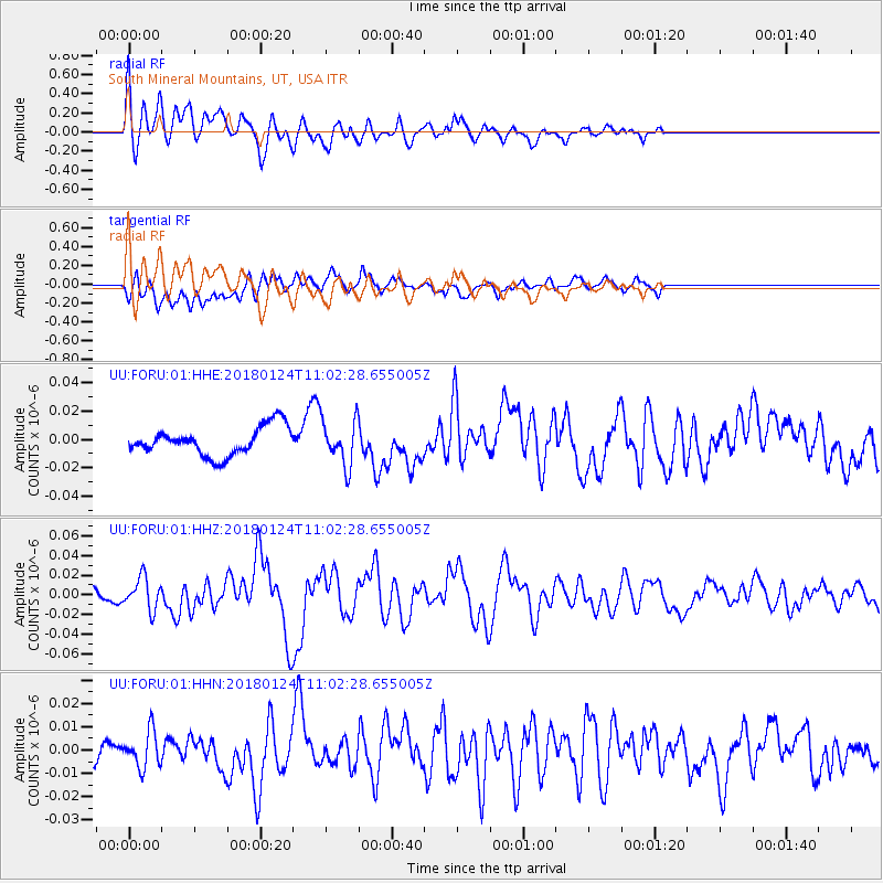
FORU South Mineral Mountains, UT, USA - Earthquake Result Viewer
*The percent match for this event was below the threshold and hence no stack was calculated.
| Earthquake location: |
Hokkaido, Japan Region |
| Earthquake latitude/longitude: |
41.1/142.3 |
| Earthquake time(UTC): |
2018/01/24 (024) 10:51:20 GMT |
| Earthquake Depth: |
40 km |
| Earthquake Magnitude: |
6.2 Mww |
| Earthquake Catalog/Contributor: |
NEIC PDE/us |
|
| Network: |
UU University of Utah Regional Network |
| Station: |
FORU South Mineral Mountains, UT, USA |
| Lat/Lon: |
38.46 N/112.86 W |
| Elevation: |
1840 m |
|
| Distance: |
75.3 deg |
| Az: |
51.682 deg |
| Baz: |
310.974 deg |
| Ray Param: |
$rayparam |
*The percent match for this event was below the threshold and hence was not used in the summary stack. |
|
| Radial Match: |
75.339386 % |
| Radial Bump: |
400 |
| Transverse Match: |
61.56702 % |
| Transverse Bump: |
400 |
| SOD ConfigId: |
2546091 |
| Insert Time: |
2018-02-07 10:58:32.105 +0000 |
| GWidth: |
2.5 |
| Max Bumps: |
400 |
| Tol: |
0.001 |
|
Signal To Noise
| Channel | StoN | STA | LTA |
| UU:FORU:01:HHZ:20180124T11:02:28.655005Z | 3.144017 | 1.597748E-8 | 5.0818687E-9 |
| UU:FORU:01:HHN:20180124T11:02:28.655005Z | 1.4272193 | 7.6668405E-9 | 5.3718727E-9 |
| UU:FORU:01:HHE:20180124T11:02:28.655005Z | 1.6014427 | 1.6073036E-8 | 1.0036598E-8 |
| Arrivals |
| Ps | |
| PpPs | |
| PsPs/PpSs | |


