You are here: Home > Network List > US - United States National Seismic Network Stations List
> Station HDIL Hopedale, Illinois, USA > Earthquake Result Viewer
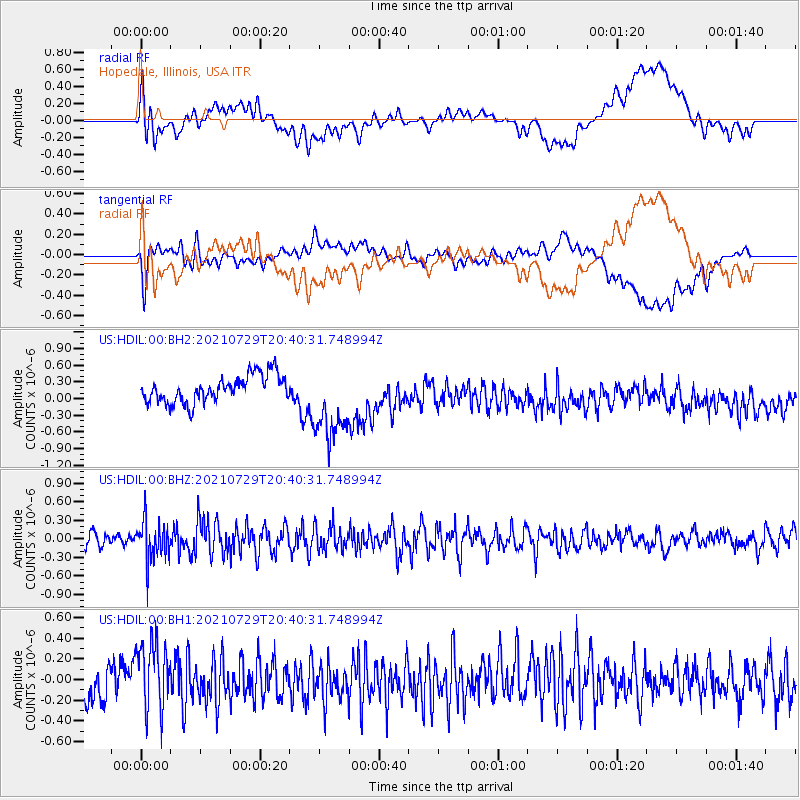
HDIL Hopedale, Illinois, USA - Earthquake Result Viewer
*The percent match for this event was below the threshold and hence no stack was calculated.
| Earthquake location: |
South Of Alaska |
| Earthquake latitude/longitude: |
55.3/-156.9 |
| Earthquake time(UTC): |
2021/07/29 (210) 20:32:44 GMT |
| Earthquake Depth: |
45 km |
| Earthquake Magnitude: |
5.5 ml |
| Earthquake Catalog/Contributor: |
NEIC PDE/ak |
|
| Network: |
US United States National Seismic Network |
| Station: |
HDIL Hopedale, Illinois, USA |
| Lat/Lon: |
40.56 N/89.29 W |
| Elevation: |
219 m |
|
| Distance: |
45.8 deg |
| Az: |
79.35 deg |
| Baz: |
312.444 deg |
| Ray Param: |
$rayparam |
*The percent match for this event was below the threshold and hence was not used in the summary stack. |
|
| Radial Match: |
42.520798 % |
| Radial Bump: |
400 |
| Transverse Match: |
48.606396 % |
| Transverse Bump: |
400 |
| SOD ConfigId: |
25131211 |
| Insert Time: |
2021-08-12 20:52:40.389 +0000 |
| GWidth: |
2.5 |
| Max Bumps: |
400 |
| Tol: |
0.001 |
|
Signal To Noise
| Channel | StoN | STA | LTA |
| US:HDIL:00:BHZ:20210729T20:40:31.748994Z | 3.4540577 | 3.2869752E-7 | 9.516272E-8 |
| US:HDIL:00:BH1:20210729T20:40:31.748994Z | 2.5518525 | 3.4402004E-7 | 1.3481188E-7 |
| US:HDIL:00:BH2:20210729T20:40:31.748994Z | 2.9134219 | 7.038915E-7 | 2.41603E-7 |
| Arrivals |
| Ps | |
| PpPs | |
| PsPs/PpSs | |


