You are here: Home > Network List > US - United States National Seismic Network Stations List
> Station OGNE Ogallala, Nebraska, USA > Earthquake Result Viewer
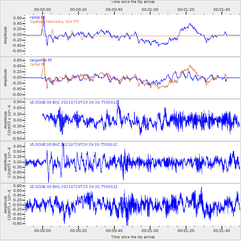
OGNE Ogallala, Nebraska, USA - Earthquake Result Viewer
*The percent match for this event was below the threshold and hence no stack was calculated.
| Earthquake location: |
South Of Alaska |
| Earthquake latitude/longitude: |
55.3/-156.9 |
| Earthquake time(UTC): |
2021/07/29 (210) 20:32:44 GMT |
| Earthquake Depth: |
45 km |
| Earthquake Magnitude: |
5.5 ml |
| Earthquake Catalog/Contributor: |
NEIC PDE/ak |
|
| Network: |
US United States National Seismic Network |
| Station: |
OGNE Ogallala, Nebraska, USA |
| Lat/Lon: |
40.95 N/102.03 W |
| Elevation: |
1054 m |
|
| Distance: |
38.3 deg |
| Az: |
88.525 deg |
| Baz: |
310.975 deg |
| Ray Param: |
$rayparam |
*The percent match for this event was below the threshold and hence was not used in the summary stack. |
|
| Radial Match: |
48.81064 % |
| Radial Bump: |
400 |
| Transverse Match: |
53.12457 % |
| Transverse Bump: |
400 |
| SOD ConfigId: |
25131211 |
| Insert Time: |
2021-08-12 20:52:58.148 +0000 |
| GWidth: |
2.5 |
| Max Bumps: |
400 |
| Tol: |
0.001 |
|
Signal To Noise
| Channel | StoN | STA | LTA |
| US:OGNE:00:BHZ:20210729T20:39:30.750001Z | 2.225532 | 3.6905502E-7 | 1.6582777E-7 |
| US:OGNE:00:BH1:20210729T20:39:30.750001Z | 1.3408706 | 2.4963427E-7 | 1.8617327E-7 |
| US:OGNE:00:BH2:20210729T20:39:30.750001Z | 1.3547345 | 2.694807E-7 | 1.9891772E-7 |
| Arrivals |
| Ps | |
| PpPs | |
| PsPs/PpSs | |


