You are here: Home > Network List > US - United States National Seismic Network Stations List
> Station AGMN Agassiz National Wildlife Refuge, Minnesota, USA > Earthquake Result Viewer
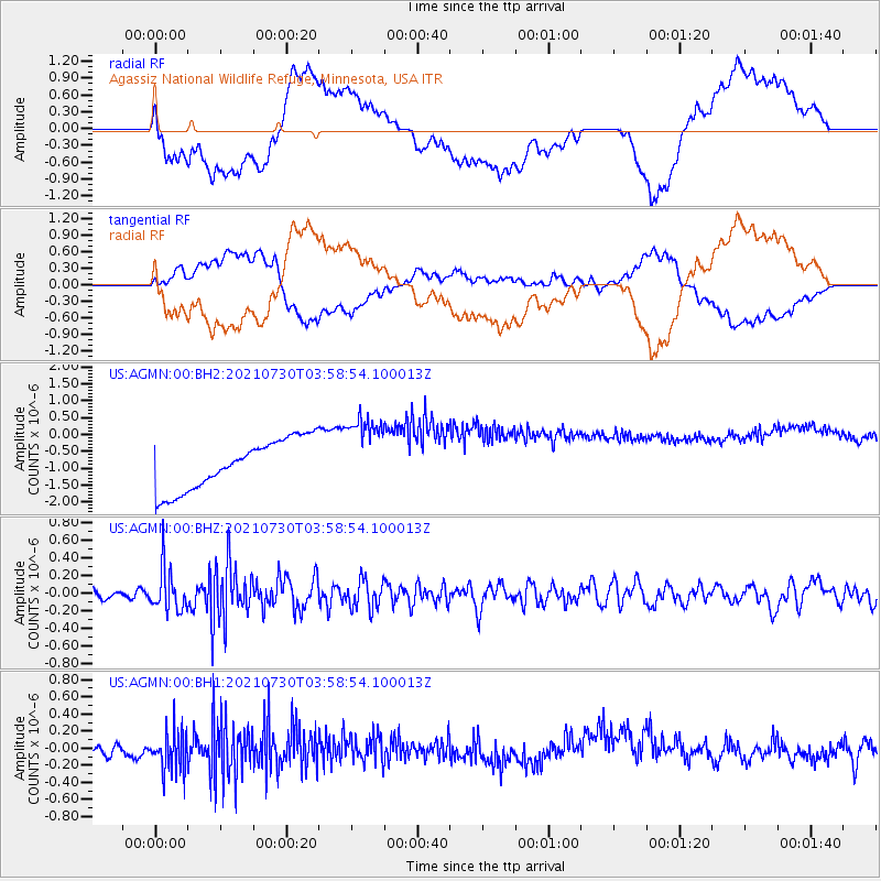
AGMN Agassiz National Wildlife Refuge, Minnesota, USA - Earthquake Result Viewer
*The percent match for this event was below the threshold and hence no stack was calculated.
| Earthquake location: |
South Of Alaska |
| Earthquake latitude/longitude: |
55.4/-157.0 |
| Earthquake time(UTC): |
2021/07/30 (211) 03:52:15 GMT |
| Earthquake Depth: |
33 km |
| Earthquake Magnitude: |
5.5 Mww |
| Earthquake Catalog/Contributor: |
NEIC PDE/ak |
|
| Network: |
US United States National Seismic Network |
| Station: |
AGMN Agassiz National Wildlife Refuge, Minnesota, USA |
| Lat/Lon: |
48.30 N/95.86 W |
| Elevation: |
351 m |
|
| Distance: |
37.3 deg |
| Az: |
74.662 deg |
| Baz: |
304.427 deg |
| Ray Param: |
$rayparam |
*The percent match for this event was below the threshold and hence was not used in the summary stack. |
|
| Radial Match: |
34.11633 % |
| Radial Bump: |
400 |
| Transverse Match: |
31.32017 % |
| Transverse Bump: |
400 |
| SOD ConfigId: |
25131211 |
| Insert Time: |
2021-08-13 04:10:01.389 +0000 |
| GWidth: |
2.5 |
| Max Bumps: |
400 |
| Tol: |
0.001 |
|
Signal To Noise
| Channel | StoN | STA | LTA |
| US:AGMN:00:BHZ:20210730T03:58:54.100013Z | 4.4552994 | 2.4021773E-7 | 5.3917304E-8 |
| US:AGMN:00:BH1:20210730T03:58:54.100013Z | 2.4890115 | 2.5808754E-7 | 1.0369077E-7 |
| US:AGMN:00:BH2:20210730T03:58:54.100013Z | 1.5163449 | 1.1222713E-6 | 7.4011615E-7 |
| Arrivals |
| Ps | |
| PpPs | |
| PsPs/PpSs | |


